Area Overview for CV6 4RB
Photos of CV6 4RB
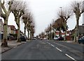
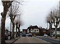

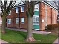
54 photos from this area
Area Information
Key information about the CV6 4RB including its size, population, and administrative classification.
- Area Type
- Postcode
- Area Size
- 5155 m²
- Population
- 2318
- Population Density
- 3157 people/km²
House Prices in CV6 4RB
62
Properties
£266,121
Average Sold Price
£227,246
Lowest Price
£304,995
Highest Price
Showing 62 properties
| Address | Type | Beds | Baths | Last Sale Price | Last Sale Date | |
|---|---|---|---|---|---|---|
| 34 Firecrest Close, Coventry, CV6 4RB | house | - | - | £227,246 | Dec 2024 | |
| 28 Firecrest Close, Coventry, CV6 4RB | house | - | - | £304,995 | Dec 2024 | |
| 54 Firecrest Close, Coventry, CV6 4RB | Flat | 2 | 1 | - | - | |
| Bin Store 14 To 44, Eliot Gardens, Coventry, CV6 4RB | Industrial | - | - | - | - | |
| Bin Store 19 To 49, Firecrest Close, Coventry, CV6 4RB | Industrial | - | - | - | - | |
| Bin Store 40 To 70, Firecrest Close, Coventry, CV6 4RB | Industrial | - | - | - | - | |
| 31 Firecrest Close, Coventry, CV6 4RB | Flat | - | - | - | - | |
| 46 Firecrest Close, Coventry, CV6 4RB | Flat | - | - | - | - | |
| 3 Firecrest Close, Coventry, CV6 4RB | Detached | 4 | 2 | - | - | |
| 7 Firecrest Close, Coventry, CV6 4RB | Detached | 4 | 2 | - | - |
Page 1 of 7
Energy Efficiency in CV6 4RB
Amenities
Schools
| Rank | School | Type | Entry gender | Ages |
|---|
Explore more schools in this area
Go to Schools tabDemographics
Household Size
Family (3-5 people)
most common
Accommodation Type
Houses
most common
Tenure
56
majority
Ethnic Group
White
most common
Religion
N/A
most common
Household Composition
N/A
most common
Age
47
median
Adults (30-64 years)
most common
Household Deprivation
N/A
with no deprivation
NS-SEC
17
in Lower managerial occupations
Explore more demographic insights in this area
Go to Demographics tabPlanning
Planning Constraints
- Flood RiskPremium
- Ramsar Wetland SitesPremium
- Area of Outstanding Natural BeautyPremium
- Protected Nature ReservePremium
- Protected WoodlandPremium