Area Overview for CV6 4GS
Photos of CV6 4GS
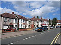
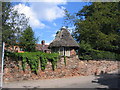

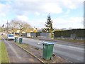
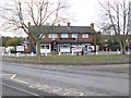
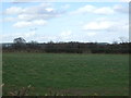
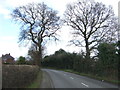
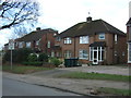
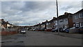
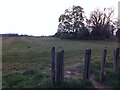
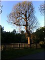
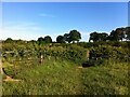
36 photos from this area
Area Information
Key information about the CV6 4GS including its size, population, and administrative classification.
- Area Type
- Postcode
- Area Size
- 5401 m²
- Population
- 1589
- Population Density
- 4735 people/km²
House Prices in CV6 4GS
26
Properties
£135,463
Average Sold Price
£27,000
Lowest Price
£270,000
Highest Price
Showing 26 properties
| Address | Type | Beds | Baths | Last Sale Price | Last Sale Date | |
|---|---|---|---|---|---|---|
| 47 Gospel Oak Road, Coventry, CV6 4GS | Terraced | 2 | 1 | £180,000 | Mar 2025 | |
| 11 Gospel Oak Road, Coventry, CV6 4GS | Terraced | 4 | 2 | £270,000 | Nov 2024 | |
| 7 Gospel Oak Road, Coventry, CV6 4GS | Terraced | 3 | 1 | £204,000 | Sep 2023 | |
| 33 Gospel Oak Road, Coventry, CV6 4GS | Terraced | 3 | 1 | £161,000 | May 2021 | |
| 3 Gospel Oak Road, Coventry, CV6 4GS | Semi-detached | 3 | 1 | £149,000 | Feb 2019 | |
| 25 Gospel Oak Road, Coventry, CV6 4GS | Terraced | 3 | 1 | £118,000 | Aug 2016 | |
| 31 Gospel Oak Road, Coventry, CV6 4GS | Terraced | 3 | 1 | £131,000 | Mar 2016 | |
| 15 Gospel Oak Road, Coventry, CV6 4GS | Terraced | 3 | 2 | £128,000 | Mar 2016 | |
| 37 Gospel Oak Road, Coventry, CV6 4GS | Terraced | 3 | - | £105,500 | Feb 2014 | |
| 21 Gospel Oak Road, Coventry, CV6 4GS | house | 3 | - | £83,000 | Jul 2011 |
Page 1 of 3
Energy Efficiency in CV6 4GS
Amenities
Schools
| Rank | School | Type | Entry gender | Ages |
|---|
Explore more schools in this area
Go to Schools tabDemographics
Household Size
Family (3-5 people)
most common
Accommodation Type
Houses
most common
Tenure
66
majority
Ethnic Group
White
most common
Religion
N/A
most common
Household Composition
N/A
most common
Age
47
median
Adults (30-64 years)
most common
Household Deprivation
N/A
with no deprivation
NS-SEC
23
in Lower managerial occupations
Explore more demographic insights in this area
Go to Demographics tabPlanning
Planning Constraints
- Flood RiskPremium
- Ramsar Wetland SitesPremium
- Area of Outstanding Natural BeautyPremium
- Protected Nature ReservePremium
- Protected WoodlandPremium