Area Overview for CV6 4EG
Photos of CV6 4EG
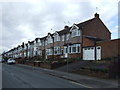
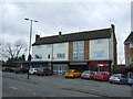
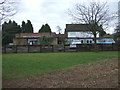
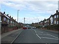
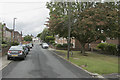
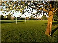
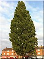
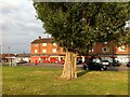
43 photos from this area
Area Information
Key information about the CV6 4EG including its size, population, and administrative classification.
- Area Type
- Postcode
- Area Size
- 1.1 hectares
- Population
- 1585
- Population Density
- 5567 people/km²
House Prices in CV6 4EG
31
Properties
£141,409
Average Sold Price
£85,000
Lowest Price
£197,500
Highest Price
Showing 31 properties
| Address | Type | Beds | Baths | Last Sale Price | Last Sale Date | |
|---|---|---|---|---|---|---|
| 12 Langlodge Road, Coventry, CV6 4EG | Terraced | 3 | 1 | £180,000 | Mar 2025 | |
| 25 Langlodge Road, Coventry, CV6 4EG | Bungalow | 2 | 1 | £197,500 | Nov 2023 | |
| 4 Langlodge Road, Coventry, CV6 4EG | house | - | - | £186,000 | Aug 2021 | |
| 34 Langlodge Road, Coventry, CV6 4EG | Bungalow | 2 | 1 | £169,000 | Jan 2021 | |
| 28 Langlodge Road, Coventry, CV6 4EG | house | - | - | £175,000 | Mar 2017 | |
| 10 Langlodge Road, Coventry, CV6 4EG | house | - | - | £85,000 | Oct 2016 | |
| 30 Langlodge Road, Coventry, CV6 4EG | Bungalow | 2 | - | £138,000 | May 2015 | |
| 14 Langlodge Road, Coventry, CV6 4EG | Terraced | 3 | - | £100,000 | Jul 2013 | |
| 2 Langlodge Road, Coventry, CV6 4EG | house | 4 | - | £122,500 | Dec 2011 | |
| 32 Langlodge Road, Coventry, CV6 4EG | Bungalow | - | - | £110,000 | Jan 2011 |
Page 1 of 4
Energy Efficiency in CV6 4EG
Amenities
Schools
| Rank | School | Type | Entry gender | Ages |
|---|
Explore more schools in this area
Go to Schools tabDemographics
Household Size
Family (3-5 people)
most common
Accommodation Type
Houses
most common
Tenure
49
majority
Ethnic Group
White
most common
Religion
N/A
most common
Household Composition
N/A
most common
Age
47
median
Adults (30-64 years)
most common
Household Deprivation
N/A
with no deprivation
NS-SEC
17
in Lower managerial occupations
Explore more demographic insights in this area
Go to Demographics tabPlanning
Planning Constraints
- Flood RiskPremium
- Ramsar Wetland SitesPremium
- Area of Outstanding Natural BeautyPremium
- Protected Nature ReservePremium
- Protected WoodlandPremium