Area Overview for CV6 3FU
Photos of CV6 3FU
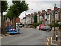
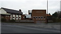
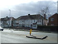
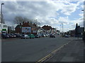

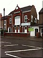
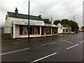
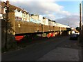

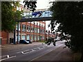
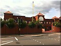
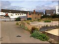
27 photos from this area
Area Information
Key information about the CV6 3FU including its size, population, and administrative classification.
- Area Type
- Postcode
- Area Size
- 7855 m²
- Population
- 1688
- Population Density
- 4203 people/km²
House Prices in CV6 3FU
32
Properties
£117,852
Average Sold Price
£38,500
Lowest Price
£260,500
Highest Price
Showing 32 properties
| Address | Type | Beds | Baths | Last Sale Price | Last Sale Date | |
|---|---|---|---|---|---|---|
| 159 Capmartin Road, Coventry, CV6 3FU | Terraced | 3 | 1 | £160,000 | Sep 2021 | |
| 123 Capmartin Road, Coventry, CV6 3FU | Terraced | 3 | 1 | £145,000 | May 2021 | |
| 183 Capmartin Road, Coventry, CV6 3FU | house | - | - | £260,500 | Oct 2019 | |
| 131 Capmartin Road, Coventry, CV6 3FU | Terraced | 3 | 1 | £121,000 | Mar 2017 | |
| 129 Capmartin Road, Coventry, CV6 3FU | Terraced | 3 | - | £127,500 | Feb 2017 | |
| 153 Capmartin Road, Coventry, CV6 3FU | Terraced | 3 | - | £144,000 | Jul 2016 | |
| 179 Capmartin Road, Coventry, CV6 3FU | Terraced | 3 | 1 | £146,000 | Mar 2016 | |
| 163 Capmartin Road, Coventry, CV6 3FU | Terraced | 3 | 1 | £93,000 | Apr 2015 | |
| 177 Capmartin Road, Coventry, CV6 3FU | Terraced | 3 | 1 | £126,500 | Apr 2015 | |
| 145 Capmartin Road, Coventry, CV6 3FU | Terraced | 3 | - | £101,000 | Mar 2015 |
Page 1 of 4
Energy Efficiency in CV6 3FU
Amenities
Schools
| Rank | School | Type | Entry gender | Ages |
|---|
Explore more schools in this area
Go to Schools tabDemographics
Household Size
Family (3-5 people)
most common
Accommodation Type
Houses
most common
Tenure
63
majority
Ethnic Group
White
most common
Religion
N/A
most common
Household Composition
N/A
most common
Age
47
median
Adults (30-64 years)
most common
Household Deprivation
N/A
with no deprivation
NS-SEC
20
in Lower managerial occupations
Explore more demographic insights in this area
Go to Demographics tabPlanning
Planning Constraints
- Flood RiskPremium
- Ramsar Wetland SitesPremium
- Area of Outstanding Natural BeautyPremium
- Protected Nature ReservePremium
- Protected WoodlandPremium