Area Overview for CV6 2JA
Photos of CV6 2JA
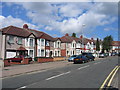
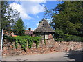
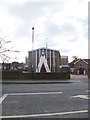
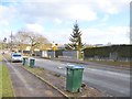
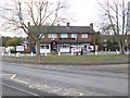
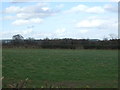
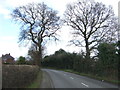
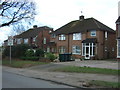
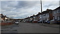
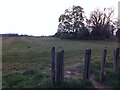
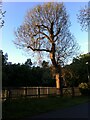
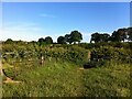
36 photos from this area
Area Information
Key information about the CV6 2JA including its size, population, and administrative classification.
- Area Type
- Postcode
- Area Size
- 1.6 hectares
- Population
- 2142
- Population Density
- 5506 people/km²
House Prices in CV6 2JA
25
Properties
£143,115
Average Sold Price
£62,500
Lowest Price
£220,000
Highest Price
Showing 25 properties
| Address | Type | Beds | Baths | Last Sale Price | Last Sale Date | |
|---|---|---|---|---|---|---|
| 554 Beake Avenue, Coventry, CV6 2JA | Terraced | 3 | 1 | £220,000 | May 2024 | |
| 524 Beake Avenue, Coventry, CV6 2JA | Terraced | 3 | 1 | £185,000 | Jul 2021 | |
| 546 Beake Avenue, Coventry, CV6 2JA | house | - | - | £211,000 | May 2021 | |
| 564 Beake Avenue, Coventry, CV6 2JA | Terraced | 3 | 1 | £180,000 | Feb 2021 | |
| 562 Beake Avenue, Coventry, CV6 2JA | Terraced | 3 | 2 | £215,000 | Aug 2020 | |
| 558 Beake Avenue, Coventry, CV6 2JA | Terraced | 3 | - | £110,000 | Jan 2014 | |
| 540 Beake Avenue, Coventry, CV6 2JA | Terraced | - | - | £100,000 | Dec 2012 | |
| 542 Beake Avenue, Coventry, CV6 2JA | Terraced | 3 | 1 | £127,000 | Oct 2012 | |
| 532 Beake Avenue, Coventry, CV6 2JA | Semi-detached | 3 | 2 | £150,000 | Nov 2007 | |
| 530A Beake Avenue, Coventry, CV6 2JA | Semi-detached | - | - | £110,000 | Jul 2003 |
Page 1 of 3
Energy Efficiency in CV6 2JA
Amenities
Schools
| Rank | School | Type | Entry gender | Ages |
|---|
Explore more schools in this area
Go to Schools tabDemographics
Household Size
Family (3-5 people)
most common
Accommodation Type
Houses
most common
Tenure
78
majority
Ethnic Group
White
most common
Religion
N/A
most common
Household Composition
N/A
most common
Age
47
median
Adults (30-64 years)
most common
Household Deprivation
N/A
with no deprivation
NS-SEC
27
in Lower managerial occupations
Explore more demographic insights in this area
Go to Demographics tabPlanning
Planning Constraints
- Flood RiskPremium
- Ramsar Wetland SitesPremium
- Area of Outstanding Natural BeautyPremium
- Protected Nature ReservePremium
- Protected WoodlandPremium