Area Overview for CV6 1LA
Photos of CV6 1LA
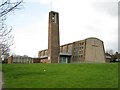
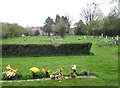
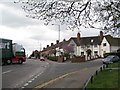
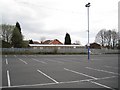
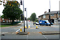
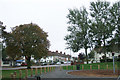
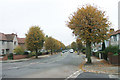
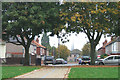
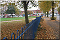
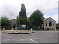
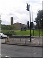
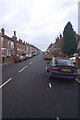
75 photos from this area
Area Information
Key information about the CV6 1LA including its size, population, and administrative classification.
- Area Type
- Postcode
- Area Size
- 1.9 hectares
- Population
- 1563
- Population Density
- 6981 people/km²
House Prices in CV6 1LA
48
Properties
£136,250
Average Sold Price
£36,500
Lowest Price
£225,000
Highest Price
Showing 48 properties
| Address | Type | Beds | Baths | Last Sale Price | Last Sale Date | |
|---|---|---|---|---|---|---|
| 130 Three Spires Avenue, Coventry, CV6 1LA | Terraced | 3 | 1 | £178,500 | Feb 2023 | |
| 162 Three Spires Avenue, Coventry, CV6 1LA | Semi-detached | 3 | 2 | £225,000 | Sep 2022 | |
| 136 Three Spires Avenue, Coventry, CV6 1LA | Semi-detached | 2 | 1 | £209,000 | Aug 2022 | |
| 186 Three Spires Avenue, Coventry, CV6 1LA | house | - | - | £155,000 | Aug 2021 | |
| 182 Three Spires Avenue, Coventry, CV6 1LA | house | 3 | - | £163,000 | May 2021 | |
| 118 Three Spires Avenue, Coventry, CV6 1LA | Terraced | 3 | 1 | £198,500 | Sep 2019 | |
| 176 Three Spires Avenue, Coventry, CV6 1LA | Terraced | 3 | 1 | £160,000 | Mar 2018 | |
| 150 Three Spires Avenue, Coventry, CV6 1LA | house | - | - | £155,000 | Feb 2018 | |
| 168 Three Spires Avenue, Coventry, CV6 1LA | Terraced | 3 | 1 | £150,000 | Jun 2017 | |
| 166 Three Spires Avenue, Coventry, CV6 1LA | Semi-detached | 3 | 1 | £136,000 | Aug 2015 |
Page 1 of 5
Energy Efficiency in CV6 1LA
Amenities
Schools
| Rank | School | Type | Entry gender | Ages |
|---|
Explore more schools in this area
Go to Schools tabDemographics
Household Size
Family (3-5 people)
most common
Accommodation Type
Houses
most common
Tenure
72
majority
Ethnic Group
White
most common
Religion
N/A
most common
Household Composition
N/A
most common
Age
47
median
Adults (30-64 years)
most common
Household Deprivation
N/A
with no deprivation
NS-SEC
27
in Lower managerial occupations
Explore more demographic insights in this area
Go to Demographics tabPlanning
Planning Constraints
- Flood RiskPremium
- Ramsar Wetland SitesPremium
- Area of Outstanding Natural BeautyPremium
- Protected Nature ReservePremium
- Protected WoodlandPremium