Area Overview for CV6 1HT
Photos of CV6 1HT

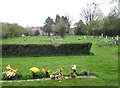
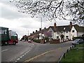
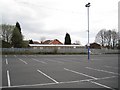
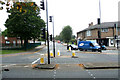
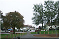
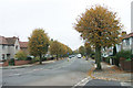
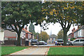
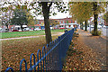
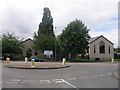
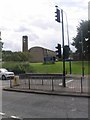
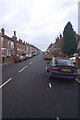
75 photos from this area
Area Information
Key information about the CV6 1HT including its size, population, and administrative classification.
- Area Type
- Postcode
- Area Size
- 1.3 hectares
- Population
- 1563
- Population Density
- 6981 people/km²
House Prices in CV6 1HT
24
Properties
£166,814
Average Sold Price
£45,500
Lowest Price
£365,000
Highest Price
Showing 24 properties
| Address | Type | Beds | Baths | Last Sale Price | Last Sale Date | |
|---|---|---|---|---|---|---|
| 116 Moseley Avenue, Coventry, CV6 1HT | Detached | 3 | 1 | £270,000 | Jun 2025 | |
| 122 Moseley Avenue, Coventry, CV6 1HT | Semi-detached | 3 | 1 | £235,000 | Dec 2023 | |
| 124 Moseley Avenue, Coventry, CV6 1HT | house | - | - | £365,000 | Aug 2022 | |
| 128 Moseley Avenue, Coventry, CV6 1HT | Semi-detached | 3 | 1 | £200,000 | Feb 2022 | |
| 130 Moseley Avenue, Coventry, CV6 1HT | house | - | - | £217,000 | Aug 2021 | |
| 140 Moseley Avenue, Coventry, CV6 1HT | house | - | - | £150,000 | Apr 2018 | |
| 136 Moseley Avenue, Coventry, CV6 1HT | house | - | - | £184,000 | Oct 2015 | |
| 134 Moseley Avenue, Coventry, CV6 1HT | house | - | - | £179,950 | May 2015 | |
| 146 Moseley Avenue, Coventry, CV6 1HT | house | - | - | £125,000 | Nov 2012 | |
| 142 Moseley Avenue, Coventry, CV6 1HT | Semi-detached | 3 | 1 | £129,000 | Aug 2011 |
Page 1 of 3
Energy Efficiency in CV6 1HT
Amenities
Schools
| Rank | School | Type | Entry gender | Ages |
|---|
Explore more schools in this area
Go to Schools tabDemographics
Household Size
Family (3-5 people)
most common
Accommodation Type
Houses
most common
Tenure
72
majority
Ethnic Group
White
most common
Religion
N/A
most common
Household Composition
N/A
most common
Age
47
median
Adults (30-64 years)
most common
Household Deprivation
N/A
with no deprivation
NS-SEC
27
in Lower managerial occupations
Explore more demographic insights in this area
Go to Demographics tabPlanning
Planning Constraints
- Flood RiskPremium
- Ramsar Wetland SitesPremium
- Area of Outstanding Natural BeautyPremium
- Protected Nature ReservePremium
- Protected WoodlandPremium