Area Overview for CV6 1DT
Photos of CV6 1DT

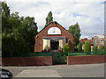
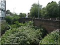
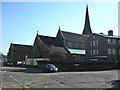
100 photos from this area
Area Information
Key information about the CV6 1DT including its size, population, and administrative classification.
- Area Type
- Postcode
- Area Size
- 1.0 hectares
- Population
- 1567
- Population Density
- 7000 people/km²
House Prices in CV6 1DT
18
Properties
£135,864
Average Sold Price
£38,000
Lowest Price
£215,000
Highest Price
Showing 18 properties
| Address | Type | Beds | Baths | Last Sale Price | Last Sale Date | |
|---|---|---|---|---|---|---|
| 64 Barkers Butts Lane, Coventry, CV6 1DT | house | - | - | £215,000 | Nov 2022 | |
| 36 Barkers Butts Lane, Coventry, CV6 1DT | Terraced | 4 | 2 | £175,000 | Jul 2022 | |
| 42 Barkers Butts Lane, Coventry, CV6 1DT | house | - | - | £195,000 | Nov 2021 | |
| 62 Barkers Butts Lane, Coventry, CV6 1DT | Terraced | 3 | 1 | £193,000 | Nov 2021 | |
| 38 Barkers Butts Lane, Coventry, CV6 1DT | house | - | - | £168,000 | Feb 2021 | |
| 58 Barkers Butts Lane, Coventry, CV6 1DT | Semi-detached | 3 | 1 | £175,000 | Dec 2019 | |
| 54 Barkers Butts Lane, Coventry, CV6 1DT | house | - | - | £92,500 | Dec 2004 | |
| 48 Barkers Butts Lane, Coventry, CV6 1DT | house | - | - | £85,000 | Feb 2004 | |
| 60 Barkers Butts Lane, Coventry, CV6 1DT | house | 3 | 1 | £110,000 | Nov 2003 | |
| 40 Barkers Butts Lane, Coventry, CV6 1DT | house | - | - | £38,000 | Mar 1998 |
Page 1 of 2
Energy Efficiency in CV6 1DT
Amenities
Schools
| Rank | School | Type | Entry gender | Ages |
|---|
Explore more schools in this area
Go to Schools tabDemographics
Household Size
One person
most common
Accommodation Type
Houses
most common
Tenure
29
majority
Ethnic Group
White
most common
Religion
N/A
most common
Household Composition
N/A
most common
Age
47
median
Adults (30-64 years)
most common
Household Deprivation
N/A
with no deprivation
NS-SEC
15
in Lower managerial occupations
Explore more demographic insights in this area
Go to Demographics tabPlanning
Planning Constraints
- Flood RiskPremium
- Ramsar Wetland SitesPremium
- Area of Outstanding Natural BeautyPremium
- Protected Nature ReservePremium
- Protected WoodlandPremium