Area Overview for CV6 1BP
Photos of CV6 1BP
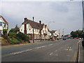
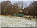
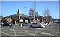

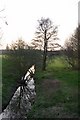
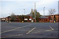
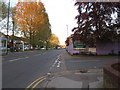
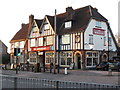
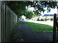
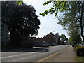
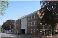
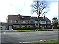
55 photos from this area
Area Information
Key information about the CV6 1BP including its size, population, and administrative classification.
- Area Type
- Postcode
- Area Size
- 4732 m²
- Population
- 1504
- Population Density
- 6021 people/km²
House Prices in CV6 1BP
23
Properties
£124,409
Average Sold Price
£52,000
Lowest Price
£210,000
Highest Price
Showing 23 properties
| Address | Type | Beds | Baths | Last Sale Price | Last Sale Date | |
|---|---|---|---|---|---|---|
| 38 Evenlode Crescent, Coventry, CV6 1BP | Terraced | 2 | 1 | £160,000 | Mar 2024 | |
| 36 Evenlode Crescent, Coventry, CV6 1BP | house | 3 | 1 | £210,000 | Apr 2023 | |
| 40 Evenlode Crescent, Coventry, CV6 1BP | Terraced | 2 | 1 | £175,500 | Jul 2021 | |
| 46 Evenlode Crescent, Coventry, CV6 1BP | house | - | - | £155,000 | May 2018 | |
| 28 Evenlode Crescent, Coventry, CV6 1BP | house | - | - | £133,000 | Jul 2008 | |
| 44 Evenlode Crescent, Coventry, CV6 1BP | house | - | - | £136,000 | Jul 2007 | |
| 42 Evenlode Crescent, Coventry, CV6 1BP | Terraced | 2 | 1 | £120,000 | May 2006 | |
| 14 Evenlode Crescent, Coventry, CV6 1BP | house | - | - | £115,000 | Jun 2005 | |
| 24 Evenlode Crescent, Coventry, CV6 1BP | Terraced | 3 | 1 | £58,500 | May 2001 | |
| 10 Evenlode Crescent, Coventry, CV6 1BP | Terraced | - | - | £53,500 | Jan 1998 |
Page 1 of 3
Energy Efficiency in CV6 1BP
Amenities
Schools
| Rank | School | Type | Entry gender | Ages |
|---|
Explore more schools in this area
Go to Schools tabDemographics
Household Size
Family (3-5 people)
most common
Accommodation Type
Houses
most common
Tenure
83
majority
Ethnic Group
White
most common
Religion
N/A
most common
Household Composition
N/A
most common
Age
47
median
Adults (30-64 years)
most common
Household Deprivation
N/A
with no deprivation
NS-SEC
35
in Lower managerial occupations
Explore more demographic insights in this area
Go to Demographics tabPlanning
Planning Constraints
- Flood RiskPremium
- Ramsar Wetland SitesPremium
- Area of Outstanding Natural BeautyPremium
- Protected Nature ReservePremium
- Protected WoodlandPremium