Area Overview for CV5 9QX
Photos of CV5 9QX


Area Information
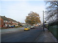
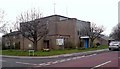
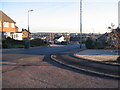
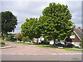
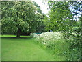
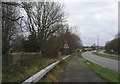
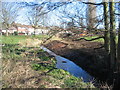
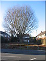
CV5 9QX is a small residential postcode cluster in Coventry, a city with a medieval heritage rooted in cloth and wool industries. With a population of 1,418, it is a compact area characterised by a mix of historic and modern housing. The ward, known as Woodlands, is home to Woodlands School, a landmark institution built in 1954 using prefabricated design. This area is notable for its quiet, residential vibe, with a strong sense of community centred around local amenities. Proximity to Coventry’s historical and cultural sites, combined with modern infrastructure, makes it appealing for families and professionals. The area’s small size means it is tightly knit, with residents often knowing their neighbours. Nearby, rail links to Canley, Tile Hill, and Berkswell provide easy access to wider Coventry and surrounding regions. The presence of retail outlets like Co-op Sutherland and Farmfoods Allesley ensures daily convenience. For those seeking a balance between heritage and practicality, CV5 9QX offers a distinct blend of stability and accessibility.
- Area Type
- Postcode
- Area Size
- Not available
- Population
- 1418
- Population Density
- 3987 people/km²
The property market in CV5 9QX is dominated by owner-occupied homes, with 88% of properties in private hands. The accommodation type is primarily houses, reflecting a residential area with larger, more permanent dwellings. This suggests a market skewed towards long-term residents rather than renters, which can affect availability for buyers. The small size of the postcode area means the housing stock is limited, potentially making the market competitive for new buyers. The high home ownership rate indicates a stable, established community, which may appeal to those seeking security and a sense of place. However, the limited number of properties also means buyers should consider nearby areas for more options. The prevalence of houses, rather than flats or apartments, further reinforces the area’s character as a traditional, family-friendly neighbourhood.
House Prices in CV5 9QX
No properties found in this postcode.
Energy Efficiency in CV5 9QX
Living in CV5 9QX offers a mix of practical amenities and quiet convenience. The area’s retail options include Co-op Sutherland, Budgens Jardine, and Farmfoods Allesley, providing everyday shopping needs within easy reach. For transport, five rail stations are nearby, including Canley and Tile Hill, offering direct links to Coventry’s business and cultural hubs. The proximity to Coventry Airport, listed twice in the data, may reflect redundancy but underscores the area’s accessibility for travel. While the area lacks large parks or leisure facilities, its small size fosters a close-knit community. The presence of Woodlands School, a historic institution, adds to the area’s character, with its prefabricated architecture and educational significance. For residents, daily life balances local convenience with the quietude of a residential postcode, making it suitable for those prioritising stability over expansive amenities.
Amenities
Schools
| Rank | School | Type | Entry gender | Ages |
|---|
Explore more schools in this area
Go to Schools tabDemographics
The population of CV5 9QX is 1,418, with a median age of 47, indicating a mature demographic. The majority of residents are adults aged 30–64, reflecting a community with a strong focus on family life and long-term settlement. Home ownership is high at 88%, suggesting a stable, owner-occupied environment rather than a transient rental market. The accommodation type is predominantly houses, which aligns with the area’s residential character. The predominant ethnic group is White, though specific data on diversity or minority representation is not provided. The age profile and ownership figures imply a community prioritising security and familiarity, with fewer young families or transient populations. This demographic structure may influence local services and amenities, tailored to the needs of middle-aged residents and retirees.
Household Size
Accommodation Type
Tenure
Ethnic Group
Religion
Household Composition
Age
Household Deprivation
NS-SEC
Explore more demographic insights in this area
Go to Demographics tabPlanning
Planning Constraints
- Flood RiskPremium
- Ramsar Wetland SitesPremium
- Area of Outstanding Natural BeautyPremium
- Protected Nature ReservePremium
- Protected WoodlandPremium
- Crime RiskPremium