Area Overview for CV5 9PS
Photos of CV5 9PS
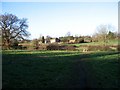
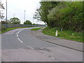
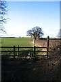

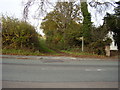
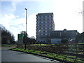


30 photos from this area
Area Information
Key information about the CV5 9PS including its size, population, and administrative classification.
- Area Type
- Postcode
- Area Size
- 3.7 hectares
- Population
- 2165
- Population Density
- 2638 people/km²
House Prices in CV5 9PS
12
Properties
£231,014
Average Sold Price
£165,145
Lowest Price
£340,000
Highest Price
Showing 12 properties
| Address | Type | Beds | Baths | Last Sale Price | Last Sale Date | |
|---|---|---|---|---|---|---|
| 11 Fenton Road, Coventry, CV5 9PS | Terraced | 3 | 1 | £255,000 | Feb 2025 | |
| 7 Fenton Road, Coventry, CV5 9PS | house | - | - | £250,000 | Feb 2024 | |
| 13 Fenton Road, Coventry, CV5 9PS | house | - | - | £230,000 | Feb 2021 | |
| 3 Fenton Road, Coventry, CV5 9PS | house | - | - | £340,000 | May 2019 | |
| 17 Fenton Road, Coventry, CV5 9PS | Semi-detached | 3 | 2 | £209,000 | Apr 2019 | |
| 9 Fenton Road, Coventry, CV5 9PS | Detached | 3 | 2 | £233,000 | Dec 2017 | |
| 15 Fenton Road, Coventry, CV5 9PS | house | - | - | £178,000 | Oct 2013 | |
| 23 Fenton Road, Coventry, CV5 9PS | house | - | - | £269,995 | Nov 2012 | |
| 19 Fenton Road, Coventry, CV5 9PS | house | - | - | £165,145 | Mar 2012 | |
| 5 Fenton Road, Coventry, CV5 9PS | house | - | - | £179,995 | Nov 2011 |
Page 1 of 2
Energy Efficiency in CV5 9PS
Amenities
Schools
| Rank | School | Type | Entry gender | Ages |
|---|
Explore more schools in this area
Go to Schools tabDemographics
Household Size
Family (3-5 people)
most common
Accommodation Type
Houses
most common
Tenure
86
majority
Ethnic Group
White
most common
Religion
N/A
most common
Household Composition
N/A
most common
Age
47
median
Adults (30-64 years)
most common
Household Deprivation
N/A
with no deprivation
NS-SEC
42
in Lower managerial occupations
Explore more demographic insights in this area
Go to Demographics tabPlanning
Planning Constraints
- Flood RiskPremium
- Ramsar Wetland SitesPremium
- Area of Outstanding Natural BeautyPremium
- Protected Nature ReservePremium
- Protected WoodlandPremium