Area Overview for CV5 9PH
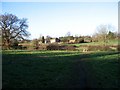
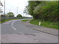
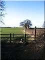
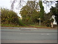
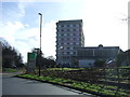
Photos of CV5 9PH


Area Information
CV5 9PH is a compact residential postcode area in England, covering just 1.4 hectares yet housing 1,594 people. This density creates a tightly knit community, where daily life is shaped by proximity to essential services and a strong local character. The area’s small size means residents can walk to nearby amenities, fostering a sense of familiarity. With a population density of 113,055 people per square kilometre, it is one of the most densely populated regions in the country, reflecting a mix of long-term residents and families. The area is dominated by houses rather than flats, aligning with its mature demographic profile. While the high population density may feel intense, it also ensures a lively local atmosphere, with shops, transport links, and community hubs within easy reach. For those seeking a balance between urban convenience and residential comfort, CV5 9PH offers a unique blend of proximity to retail, rail, and transport infrastructure, all within a small, defined space.
- Area Type
- Postcode
- Area Size
- 1.4 hectares
- Population
- 1594
- Population Density
- 3777 people/km²
The property market in CV5 9PH is characterised by high home ownership, with 67% of properties owner-occupied. This suggests a stable market where long-term residents dominate, rather than a rental-focused area. The accommodation type is primarily houses, which is atypical for a small, densely populated postcode. This may indicate a mix of older, larger homes and newer developments, though the exact age of properties is not specified. Given the area’s compact size, the housing stock is limited, and buyers should consider the scarcity of available properties. The focus on houses rather than flats may appeal to those seeking more space, but it also means the market is less flexible for first-time buyers or those seeking smaller units. The high home ownership rate implies a strong local attachment, which can be both a benefit and a challenge for new buyers navigating a tight market.
House Prices in CV5 9PH
Showing 1 properties
| Address | Type | Beds | Baths | Last Sale Price | Last Sale Date | |
|---|---|---|---|---|---|---|
| Coventry Hill Hotel, Rye Hill, Coventry, CV5 9PH | hotel | - | - | - | - |
Energy Efficiency in CV5 9PH
Living in CV5 9PH provides access to a range of essential amenities within practical reach. Retail options include Co-op Sutherland, Tesco Coventry, and Budgens Jardine, offering daily shopping needs. The area’s rail network, with stations like Canley and Tile Hill, connects residents to broader transport routes, while two nearby airports cater to travel demands. Though the specific names of parks or leisure facilities are not listed, the proximity to rail and retail suggests a focus on convenience over expansive green spaces. The compact layout means residents can walk or cycle to shops, stations, and other services, fostering a self-contained lifestyle. The presence of multiple retail outlets and transport links contributes to a practical, efficient daily routine, though the area’s density may limit opportunities for larger recreational spaces.
Amenities
Schools
| Rank | School | Type | Entry gender | Ages |
|---|
Explore more schools in this area
Go to Schools tabDemographics
The residents of CV5 9PH are predominantly adults aged 30–64, with a median age of 47. This suggests a stable, established community where many have lived for years. Home ownership is high, with 67% of properties owner-occupied, indicating a strong local presence and investment in the area. The majority of housing is composed of houses, not flats or apartments, which is unusual for a densely populated postcode. The predominant ethnic group is White, reflecting a homogenous demographic profile. The area’s population density of 113,055 per square kilometre is exceptionally high, which may influence the pace of life and the character of interactions. While this density can create a sense of community, it also means limited space for expansion or new developments. The age profile suggests a focus on family life, with a mix of professionals and retirees contributing to the area’s dynamic.
Household Size
Accommodation Type
Tenure
Ethnic Group
Religion
Household Composition
Age
Household Deprivation
NS-SEC
Explore more demographic insights in this area
Go to Demographics tabPlanning
Planning Constraints
- Flood RiskPremium
- Ramsar Wetland SitesPremium
- Area of Outstanding Natural BeautyPremium
- Protected Nature ReservePremium
- Protected WoodlandPremium