Area Overview for CV5 9PG
Photos of CV5 9PG

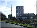


30 photos from this area
Area Information
Key information about the CV5 9PG including its size, population, and administrative classification.
- Area Type
- Postcode
- Area Size
- 1.7 hectares
- Population
- 2165
- Population Density
- 2638 people/km²
House Prices in CV5 9PG
51
Properties
£184,861
Average Sold Price
£31,000
Lowest Price
£295,000
Highest Price
Showing 51 properties
| Address | Type | Beds | Baths | Last Sale Price | Last Sale Date | |
|---|---|---|---|---|---|---|
| 16 Seashell Close, Coventry, CV5 9PG | Terraced | 4 | 1 | £285,000 | Feb 2025 | |
| 77 Seashell Close, Coventry, CV5 9PG | Flat | - | - | £150,000 | Nov 2024 | |
| 8 Seashell Close, Coventry, CV5 9PG | Terraced | 4 | 3 | £275,000 | Jul 2024 | |
| 1 Seashell Close, Coventry, CV5 9PG | Semi-detached | 3 | 2 | £270,000 | May 2024 | |
| 79 Seashell Close, Coventry, CV5 9PG | Flat | - | - | £146,000 | Jan 2022 | |
| 10 Seashell Close, Coventry, CV5 9PG | Terraced | 4 | 3 | £262,000 | Sep 2021 | |
| 39 Seashell Close, Coventry, CV5 9PG | house | - | - | £60,000 | Apr 2021 | |
| 9 Seashell Close, Coventry, CV5 9PG | house | 3 | - | £295,000 | Jan 2021 | |
| 73 Seashell Close, Coventry, CV5 9PG | Flat | - | - | £145,000 | Dec 2020 | |
| 69 Seashell Close, Coventry, CV5 9PG | Flat | 2 | 1 | £130,000 | Oct 2019 |
Page 1 of 6
Energy Efficiency in CV5 9PG
Amenities
Schools
| Rank | School | Type | Entry gender | Ages |
|---|
Explore more schools in this area
Go to Schools tabDemographics
Household Size
Family (3-5 people)
most common
Accommodation Type
Houses
most common
Tenure
86
majority
Ethnic Group
White
most common
Religion
N/A
most common
Household Composition
N/A
most common
Age
47
median
Adults (30-64 years)
most common
Household Deprivation
N/A
with no deprivation
NS-SEC
42
in Lower managerial occupations
Explore more demographic insights in this area
Go to Demographics tabPlanning
Planning Constraints
- Flood RiskPremium
- Ramsar Wetland SitesPremium
- Area of Outstanding Natural BeautyPremium
- Protected Nature ReservePremium
- Protected WoodlandPremium