Area Overview for CV5 9NN
Photos of CV5 9NN

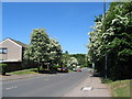
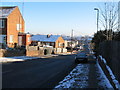
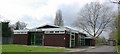
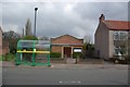

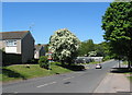
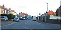
100 photos from this area
Area Information
Key information about the CV5 9NN including its size, population, and administrative classification.
- Area Type
- Postcode
- Area Size
- 1.5 hectares
- Population
- 1428
- Population Density
- 3334 people/km²
House Prices in CV5 9NN
33
Properties
£224,448
Average Sold Price
£107,500
Lowest Price
£385,000
Highest Price
Showing 33 properties
| Address | Type | Beds | Baths | Last Sale Price | Last Sale Date | |
|---|---|---|---|---|---|---|
| 57 Pangfield Park, Coventry, CV5 9NN | Semi-detached | 3 | 2 | £325,000 | Mar 2025 | |
| 67 Pangfield Park, Coventry, CV5 9NN | Semi-detached | 3 | 2 | £335,000 | Jun 2024 | |
| 51 Pangfield Park, Coventry, CV5 9NN | Semi-detached | 3 | 1 | £271,056 | Jan 2024 | |
| 31 Pangfield Park, Coventry, CV5 9NN | Bungalow | - | - | £300,000 | May 2021 | |
| 53 Pangfield Park, Coventry, CV5 9NN | Detached | 4 | 2 | £307,500 | Mar 2021 | |
| 77 Pangfield Park, Coventry, CV5 9NN | Semi-detached | 3 | 1 | £255,000 | Sep 2019 | |
| 75 Pangfield Park, Coventry, CV5 9NN | Semi-detached | 4 | 1 | £250,000 | Feb 2019 | |
| 41 Pangfield Park, Coventry, CV5 9NN | Bungalow | 3 | 2 | £385,000 | Jan 2018 | |
| 45 Pangfield Park, Coventry, CV5 9NN | Semi-detached | 3 | 1 | £213,000 | Jan 2016 | |
| 83 Pangfield Park, Coventry, CV5 9NN | house | - | - | £115,000 | Sep 2015 |
Page 1 of 4
Energy Efficiency in CV5 9NN
Amenities
Schools
| Rank | School | Type | Entry gender | Ages |
|---|
Explore more schools in this area
Go to Schools tabDemographics
Household Size
Two person
most common
Accommodation Type
Houses
most common
Tenure
85
majority
Ethnic Group
White
most common
Religion
N/A
most common
Household Composition
N/A
most common
Age
47
median
Adults (30-64 years)
most common
Household Deprivation
N/A
with no deprivation
NS-SEC
35
in Lower managerial occupations
Explore more demographic insights in this area
Go to Demographics tabPlanning
Planning Constraints
- Flood RiskPremium
- Ramsar Wetland SitesPremium
- Area of Outstanding Natural BeautyPremium
- Protected Nature ReservePremium
- Protected WoodlandPremium