Area Overview for CV5 9NG
Photos of CV5 9NG
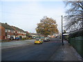


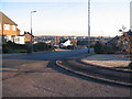


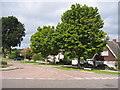
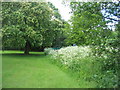
73 photos from this area
Area Information
Key information about the CV5 9NG including its size, population, and administrative classification.
- Area Type
- Postcode
- Area Size
- 2.0 hectares
- Population
- 1178
- Population Density
- 2279 people/km²
House Prices in CV5 9NG
19
Properties
£164,607
Average Sold Price
£84,250
Lowest Price
£270,000
Highest Price
Showing 19 properties
| Address | Type | Beds | Baths | Last Sale Price | Last Sale Date | |
|---|---|---|---|---|---|---|
| 177 Winsford Avenue, Coventry, CV5 9NG | house | 3 | 1 | £270,000 | Mar 2025 | |
| 187 Winsford Avenue, Coventry, CV5 9NG | Semi-detached | 3 | 1 | £242,000 | May 2020 | |
| 183 Winsford Avenue, Coventry, CV5 9NG | house | 3 | - | £175,000 | Jul 2017 | |
| 179 Winsford Avenue, Coventry, CV5 9NG | Semi-detached | - | - | £146,000 | Sep 2005 | |
| 181 Winsford Avenue, Coventry, CV5 9NG | Semi-detached | - | - | £114,000 | Jun 2003 | |
| 195 Winsford Avenue, Coventry, CV5 9NG | house | - | - | £121,000 | Nov 2000 | |
| 175 Winsford Avenue, Coventry, CV5 9NG | Terraced | - | - | £84,250 | Sep 2000 | |
| Caretakers Store, Allesley Hall Primary School, Winsford Avenue, Coventry, CV5 9NG | commercial | - | - | - | - | |
| Games Store, Allesley Hall Primary School, Winsford Avenue, Coventry, CV5 9NG | commercial | - | - | - | - | |
| Main School Building, Allesley Hall Primary School, Winsford Avenue, Coventry, CV5 9NG | commercial | - | - | - | - |
Page 1 of 2
Energy Efficiency in CV5 9NG
Amenities
Schools
| Rank | School | Type | Entry gender | Ages |
|---|
Explore more schools in this area
Go to Schools tabDemographics
Household Size
Two person
most common
Accommodation Type
Houses
most common
Tenure
92
majority
Ethnic Group
White
most common
Religion
N/A
most common
Household Composition
N/A
most common
Age
47
median
Adults (30-64 years)
most common
Household Deprivation
N/A
with no deprivation
NS-SEC
32
in Lower managerial occupations
Explore more demographic insights in this area
Go to Demographics tabPlanning
Planning Constraints
- Flood RiskPremium
- Ramsar Wetland SitesPremium
- Area of Outstanding Natural BeautyPremium
- Protected Nature ReservePremium
- Protected WoodlandPremium