Area Overview for CV5 9LN
Photos of CV5 9LN
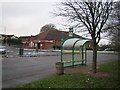
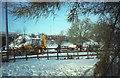
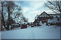
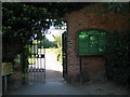
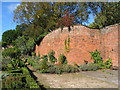
76 photos from this area
Area Information
Key information about the CV5 9LN including its size, population, and administrative classification.
- Area Type
- Postcode
- Area Size
- 2.2 hectares
- Population
- 1178
- Population Density
- 2279 people/km²
House Prices in CV5 9LN
46
Properties
£180,576
Average Sold Price
£45,000
Lowest Price
£330,000
Highest Price
Showing 46 properties
| Address | Type | Beds | Baths | Last Sale Price | Last Sale Date | |
|---|---|---|---|---|---|---|
| 39 West Ridge, Coventry, CV5 9LN | Semi-detached | 3 | 2 | £326,000 | Jul 2025 | |
| 37 West Ridge, Coventry, CV5 9LN | house | - | - | £270,000 | Feb 2022 | |
| 23 West Ridge, Coventry, CV5 9LN | Semi-detached | 3 | 2 | £290,000 | Sep 2021 | |
| 11 West Ridge, Coventry, CV5 9LN | Semi-detached | 4 | 1 | £330,000 | Aug 2019 | |
| 47 West Ridge, Coventry, CV5 9LN | house | - | - | £205,000 | Nov 2017 | |
| 42 West Ridge, Coventry, CV5 9LN | Semi-detached | 3 | 1 | £236,000 | May 2016 | |
| 25 West Ridge, Coventry, CV5 9LN | house | - | - | £160,000 | Dec 2015 | |
| 31 West Ridge, Coventry, CV5 9LN | house | - | - | £142,000 | Apr 2015 | |
| 1 West Ridge, Coventry, CV5 9LN | house | - | - | £208,000 | Sep 2014 | |
| 29 West Ridge, Coventry, CV5 9LN | house | 3 | 1 | £150,000 | Jul 2013 |
Page 1 of 5
Energy Efficiency in CV5 9LN
Amenities
Schools
| Rank | School | Type | Entry gender | Ages |
|---|
Explore more schools in this area
Go to Schools tabDemographics
Household Size
Two person
most common
Accommodation Type
Houses
most common
Tenure
92
majority
Ethnic Group
White
most common
Religion
N/A
most common
Household Composition
N/A
most common
Age
47
median
Adults (30-64 years)
most common
Household Deprivation
N/A
with no deprivation
NS-SEC
32
in Lower managerial occupations
Explore more demographic insights in this area
Go to Demographics tabPlanning
Planning Constraints
- Flood RiskPremium
- Ramsar Wetland SitesPremium
- Area of Outstanding Natural BeautyPremium
- Protected Nature ReservePremium
- Protected WoodlandPremium