Area Overview for CV5 9FB
Photos of CV5 9FB
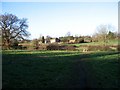
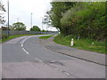
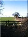

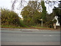
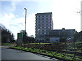


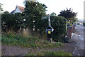
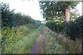


30 photos from this area
Area Information
Key information about the CV5 9FB including its size, population, and administrative classification.
- Area Type
- Postcode
- Area Size
- 3.0 hectares
- Population
- 1562
- Population Density
- 615 people/km²
House Prices in CV5 9FB
36
Properties
£304,000
Average Sold Price
£95,000
Lowest Price
£517,500
Highest Price
Showing 36 properties
| Address | Type | Beds | Baths | Last Sale Price | Last Sale Date | |
|---|---|---|---|---|---|---|
| 111 Butt Lane, Coventry, CV5 9FB | Semi-detached | 4 | 3 | £480,000 | Jan 2024 | |
| 113 Butt Lane, Coventry, CV5 9FB | Semi-detached | 3 | 2 | £517,500 | Sep 2023 | |
| 45 Butt Lane, Coventry, CV5 9FB | house | - | - | £445,000 | May 2021 | |
| 105 Butt Lane, Coventry, CV5 9FB | Semi-detached | 3 | 1 | £321,000 | Aug 2018 | |
| 115 Butt Lane, Coventry, CV5 9FB | Semi-detached | 3 | 2 | £328,000 | Mar 2017 | |
| 71 Butt Lane, Coventry, CV5 9FB | Semi-detached | 3 | 3 | £335,000 | Mar 2017 | |
| 75 Butt Lane, Coventry, CV5 9FB | Semi-detached | 3 | 2 | £265,000 | Aug 2014 | |
| 77 Butt Lane, Coventry, CV5 9FB | house | - | - | £245,000 | Jun 2014 | |
| 99 Butt Lane, Coventry, CV5 9FB | Semi-detached | 3 | 2 | £290,000 | Apr 2014 | |
| 47 Butt Lane, Coventry, CV5 9FB | Bungalow | 3 | - | £360,000 | Feb 2014 |
Page 1 of 4
Energy Efficiency in CV5 9FB
Amenities
Schools
| Rank | School | Type | Entry gender | Ages |
|---|
Explore more schools in this area
Go to Schools tabDemographics
Household Size
Family (3-5 people)
most common
Accommodation Type
Houses
most common
Tenure
85
majority
Ethnic Group
White
most common
Religion
N/A
most common
Household Composition
N/A
most common
Age
47
median
Adults (30-64 years)
most common
Household Deprivation
N/A
with no deprivation
NS-SEC
37
in Lower managerial occupations
Explore more demographic insights in this area
Go to Demographics tabPlanning
Planning Constraints
- Flood RiskPremium
- Ramsar Wetland SitesPremium
- Area of Outstanding Natural BeautyPremium
- Protected Nature ReservePremium
- Protected WoodlandPremium