Area Overview for CV5 8ZT
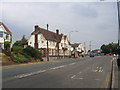
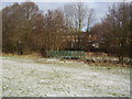
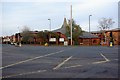
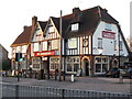
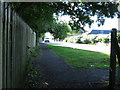
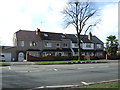
Photos of CV5 8ZT


Area Information
CV5 8ZT is a small, tightly knit residential postcode area nestled within Coventry’s western suburbs. With a population of just 1,430, it reflects a quiet, mature community centred around historic Whoberley Ward, historically linked to moated sites and former estates like Whoberley Hall. The area lies near the modern Coventry by-pass, offering a blend of suburban convenience and historical character. Daily life here is shaped by its proximity to retail hubs, rail networks, and the broader Coventry infrastructure. The low crime risk and absence of environmental constraints make it an appealing choice for those seeking stability. While the housing stock is limited to a small cluster of properties, the area’s charm lies in its compactness and accessibility to nearby amenities. For buyers, CV5 8ZT represents a rare opportunity to own a home in a low-risk, well-connected postcode with a distinct local identity.
- Area Type
- Postcode
- Area Size
- Not available
- Population
- 1430
- Population Density
- 4245 people/km²
The property market in CV5 8ZT is defined by high home ownership (77%) and a focus on houses rather than flats or apartments. This suggests a residential area where private property is the norm, with limited rental activity. The concentration of houses implies a family-oriented or semi-rural character, though the small population and compact size mean the housing stock is not extensive. For buyers, this presents both opportunities and challenges: the area’s rarity as a standalone postcode means competition may be low, but the limited number of properties could restrict choices. Proximity to Coventry’s rail network and retail corridors adds appeal, though buyers should consider nearby areas for broader options. The absence of planning constraints or environmental risks further enhances the area’s attractiveness for long-term ownership.
House Prices in CV5 8ZT
No properties found in this postcode.
Energy Efficiency in CV5 8ZT
Living in CV5 8ZT offers access to a range of practical amenities within easy reach. Retail options include major chains like Tesco Coventry, Morrisons Coundon, and the Heart of England Co-operative Co, ensuring everyday shopping needs are met. The area’s rail network, with stations such as Canley and Tile Hill, provides swift connections to Coventry’s cultural and commercial centres, as well as regional destinations. While the postcode itself is small, its proximity to the modern Coventry by-pass and historical sites like the former Whoberley Hall adds a layer of local interest. The absence of major leisure facilities within the postcode means residents may look to nearby areas for dining or entertainment, but the convenience of nearby retail and transport offsets this. The area’s character is defined by its quiet suburban feel, balanced with practical accessibility.
Amenities
Schools
| Rank | School | Type | Entry gender | Ages |
|---|
Explore more schools in this area
Go to Schools tabDemographics
The population of CV5 8ZT is 1,430, with a median age of 47, indicating a community predominantly composed of adults aged 30–64. This age range suggests a mix of established professionals and families, contributing to a stable, long-term residential profile. Home ownership is high at 77%, reflecting a preference for private property over rental living. The accommodation type is primarily houses, aligning with the area’s suburban character. The predominant ethnic group is White, which, combined with the age distribution, points to a cohesive, low-turnover community. The absence of specific deprivation data means the area likely benefits from moderate to high living standards, supported by its proximity to retail, transport, and safety. This demographic profile suggests a neighbourhood where residents value security, familiarity, and long-term investment in property.
Household Size
Accommodation Type
Tenure
Ethnic Group
Religion
Household Composition
Age
Household Deprivation
NS-SEC
Explore more demographic insights in this area
Go to Demographics tabPlanning
Planning Constraints
- Flood RiskPremium
- Ramsar Wetland SitesPremium
- Area of Outstanding Natural BeautyPremium
- Protected Nature ReservePremium
- Protected WoodlandPremium
- Crime RiskPremium