Area Overview for CV5 8NS
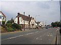
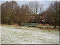
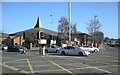
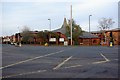
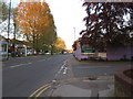
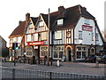
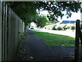
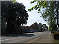
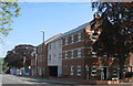
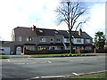
Photos of CV5 8NS


Area Information
CV5 8NS is a small residential cluster in England, home to 1,410 residents. Nestled in the West Midlands, it lies near the River Sherbourne, a historical waterway that once shaped Coventry’s medieval defences. The area’s compact size fosters a close-knit community, with homes predominantly occupied by owners, reflecting a stable, long-term demographic. The median age of 47 suggests a mature population, with most residents falling within the 30-64 age range. Daily life here is grounded in local traditions, with easy access to rail links and retail hubs. The River Sherbourne, though no longer a flood risk, remains a quiet historical presence, its legacy visible in streets like Hales Street. For buyers, CV5 8NS offers a blend of practicality and heritage, with homes set in a low-crime environment. Its proximity to Coventry’s amenities, from supermarkets to railway stations, ensures convenience without the bustle of larger cities. This is a place where history meets modern living, with a focus on safety and community.
- Area Type
- Postcode
- Area Size
- Not available
- Population
- 1410
- Population Density
- 4347 people/km²
The property market in CV5 8NS is characterised by high home ownership, with 81% of residents living in owner-occupied homes. The accommodation type is predominantly houses, reflecting a focus on family-sized properties rather than flats or apartments. This suggests a market geared towards long-term buyers seeking stability, rather than investors targeting rental income. The small area’s limited size means housing stock is likely constrained, but the high home ownership rate indicates strong local demand. For buyers, this implies a competitive market with potential for appreciation, though the small scale may limit options. The absence of rental properties suggests a community prioritising permanence, which could appeal to those seeking a settled lifestyle. However, the lack of detailed data on property types beyond houses means specifics about availability or diversity remain unclear.
House Prices in CV5 8NS
No properties found in this postcode.
Energy Efficiency in CV5 8NS
Living in CV5 8NS offers access to a range of amenities within practical reach. Retail options include Tesco Coventry, Morrisons Coundon, and the Heart of England Co-operative, ensuring everyday shopping needs are met. The area’s rail links, such as Canley and Tile Hill stations, provide direct access to Coventry’s urban centres and beyond. While no parks or leisure facilities are explicitly named in the data, the River Sherbourne’s historical presence suggests potential for walking or recreational use. The proximity to Coventry Airport and multiple rail stations enhances mobility, making it easier to travel for work or leisure. The combination of retail, transport, and historical features creates a balanced lifestyle, blending practicality with a touch of local heritage. For residents, this means a mix of convenience and quiet living, with minimal need to travel far for essentials.
Amenities
Schools
| Rank | School | Type | Entry gender | Ages |
|---|
Explore more schools in this area
Go to Schools tabDemographics
The population of CV5 8NS is predominantly adults aged 30-64, with a median age of 47. Over 81% of residents own their homes, a figure that underscores the area’s stability and long-term occupancy. The accommodation type is primarily houses, suggesting a family-oriented demographic. The predominant ethnic group is White, though specific data on diversity beyond this is not available. The age profile indicates a mature community, likely with established careers and families. With 81% home ownership, the area is less reliant on rental markets, which may influence local property values and community cohesion. The absence of detailed diversity metrics means broader demographic trends remain unexplored, but the data confirms a settled, middle-aged population. This profile aligns with a low crime risk, as noted in assessments, reinforcing a sense of security for residents.
Household Size
Accommodation Type
Tenure
Ethnic Group
Religion
Household Composition
Age
Household Deprivation
NS-SEC
Explore more demographic insights in this area
Go to Demographics tabPlanning
Planning Constraints
- Flood RiskPremium
- Ramsar Wetland SitesPremium
- Area of Outstanding Natural BeautyPremium
- Protected Nature ReservePremium
- Protected WoodlandPremium