Area Overview for CV5 8NF
Photos of CV5 8NF


Area Information
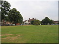
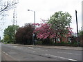
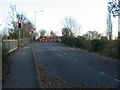
CV5 8NF is a small, tightly knit residential postcode area within Coventry City Council, situated west of the city centre near the modern Coventry by-pass. With a population of just 1,501, it reflects a quiet, low-density neighbourhood characterised by housing estates and playing fields. The area’s historical roots are evident in its name, derived from Whoberley Ward, which once encompassed moated sites and ancient estates like Whoberley Hall. Today, the landscape is a blend of modern housing and preserved green spaces, offering a balance between urban convenience and historical interest. Residents benefit from proximity to key infrastructure, including rail links and retail hubs, while the area’s compact size ensures a sense of community. Its location near the A45 motorway and Coventry’s expanding suburbs makes it accessible to both city amenities and surrounding towns. For those seeking a peaceful yet connected lifestyle, CV5 8NF provides a snapshot of Coventry’s evolving character, where heritage meets contemporary living.
- Area Type
- Postcode
- Area Size
- Not available
- Population
- 1501
- Population Density
- 6968 people/km²
The property market in CV5 8NF is shaped by its 47% home ownership rate, meaning over half of properties are rented. The area is primarily composed of houses, which are more common than flats or apartments, reflecting a preference for family homes in this suburban setting. This mix of owner-occupied and rental properties suggests a dynamic market where buyers may find opportunities in both the primary and secondary markets. The small size of the postcode area means that property values and availability are closely tied to local demand, with limited scope for large-scale development. For buyers, the focus is on individual homes rather than commercial or multi-unit properties. The lack of planning constraints, such as protected woodlands or AONB designations, allows for flexibility in property use. However, the area’s compact nature means that proximity to amenities and transport links is a key consideration for potential buyers. The housing stock’s character—predominantly single-family homes—may appeal to those seeking space and privacy in a suburban environment.
House Prices in CV5 8NF
No properties found in this postcode.
Energy Efficiency in CV5 8NF
Daily life in CV5 8NF is shaped by its proximity to a range of amenities, including five retail outlets such as Morrisons Coundon, Aldi Alvis Retail Park, and the Heart of England Co-operative Co. These shops provide essential services, from grocery shopping to general retail, supporting a self-contained lifestyle. The area’s rail links to Canley, Tile Hill, and Coventry Arena stations make commuting straightforward, while the nearby Coventry Airport offers easy access to regional and international travel. Although the area itself lacks major parks or leisure facilities, its historical context includes playing fields and green spaces, hinting at recreational opportunities. The mix of retail and transport options ensures that residents can meet most daily needs without venturing far. The presence of multiple supermarkets and a variety of shops suggests a practical, community-focused approach to living, where convenience and accessibility are prioritised. For those seeking a balance between suburban tranquillity and urban amenities, CV5 8NF delivers a functional lifestyle.
Amenities
Schools
The nearest school to CV5 8NF is All Souls’ Catholic Primary School, which provides education for younger children and holds a ‘good’ Ofsted rating. This primary school is the only explicitly listed educational institution in the area, suggesting that families may need to look beyond the immediate postcode for secondary education options. The presence of a well-rated primary school is a significant draw for families with young children, offering a stable and assessed learning environment. However, the absence of secondary schools or further education facilities within the area means that students may need to commute to nearby towns or schools in Coventry’s city centre. The single school type highlights a focus on early education, which could be a consideration for those prioritising primary schooling. For families, the quality of this primary school may offset the need for additional travel, though the overall educational ecosystem remains limited to primary-level provision.
| Rank | School | Type | Entry gender | Ages |
|---|
Explore more schools in this area
Go to Schools tabDemographics
The population of CV5 8NF is predominantly adults aged 30–64, with a median age of 47, reflecting a mature community. Home ownership rates stand at 47%, indicating a mix of owner-occupied properties and rental homes. The area is primarily composed of houses, suggesting a family-oriented housing stock. The predominant ethnic group is White, which aligns with broader trends in Coventry’s suburban areas. This demographic profile implies a stable, long-term resident base, with fewer transient populations. The absence of specific data on deprivation levels means quality of life is inferred from the area’s amenities and safety assessments. With no protected natural sites or planning constraints, the community benefits from straightforward development opportunities. However, the median age and ownership figures suggest a need for age-appropriate services and housing adaptations. The area’s character is defined by its residents’ life stages, with a focus on established households rather than younger families or students.
Household Size
Accommodation Type
Tenure
Ethnic Group
Religion
Household Composition
Age
Household Deprivation
NS-SEC
Explore more demographic insights in this area
Go to Demographics tabPlanning
Planning Constraints
- Flood RiskPremium
- Ramsar Wetland SitesPremium
- Area of Outstanding Natural BeautyPremium
- Protected Nature ReservePremium
- Protected WoodlandPremium