Area Overview for CV5 8LR
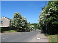
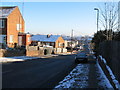
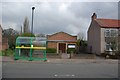
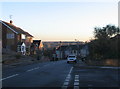
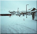
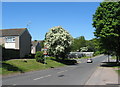
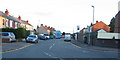
Photos of CV5 8LR


Area Information
Living in CV5 8LR offers a specific residential experience defined by its location within Whoberley Ward in Coventry. This postcode covers a cluster of homes spanning 5,709 square metres, accommodating a population of 1,482 people. The area is situated west of central Coventry, near the modern city bypass, and sits adjacent to the historic Whoberley Common. Historically, this locality dates back at least to 1250, evolving from a rural setting with a moated site to a modern housing estate. The proximity to Hearsall Common and the redeveloped Whoberley Hall site provides a backdrop that merges modern urban living with older landscape features. Residents enjoy a lifestyle where daily life is shaped by immediate access to transport links and local retail hubs like Canley. The environment avoids major planning constraints such as protected woodlands or Areas of Outstanding Natural Beauty, allowing for standard residential development. For those considering homes in this postcode, the setting provides a practical footprint for families who value proximity to both the city centre and suburban amenities without the restrictions associated with conservation zones.
- Area Type
- Postcode
- Area Size
- 5709 m²
- Population
- 1482
- Population Density
- 6413 people/km²
The property market in CV5 8LR is characterised by a distinct preference for house ownership over rental living. With 53 per cent of residents owning their homes, the area leans heavily towards owner-occupied stock rather than a bustling letting market. This high ownership rate typically points to higher resident investment and stability within the neighbourhood. The predominant accommodation type is houses, meaning the skyline is shaped by detached or semi-detached properties rather than the block structure of flats or terraced rows. When looking at homes in CV5 8LR, you are likely viewing properties designed as standalone or semi-standalone dwellings on individual plots. This contrasts with urban centres where flats command a larger share of the market. The fact that nearly half the population rents indicates a significant presence of buy-to-let landlords or professional lettings agencies catering to some residents. However, the dominance of house ownership suggests that the local economy supports families who can afford to purchase. For a buyer, this means entering a market where you will join a community of established homeowners rather than navigating a transient rental landscape. The housing stock is defined by these traditional forms, offering space and privacy typical of the suburb rather than the density of the city centre.
House Prices in CV5 8LR
Showing 60 properties
| Address | Type | Beds | Baths | Last Sale Price | Last Sale Date | |
|---|---|---|---|---|---|---|
| 23 Raphael Close, Coventry, CV5 8LR | Flat | 2 | 1 | £115,000 | Jul 2025 | |
| 42 Raphael Close, Coventry, CV5 8LR | Maisonette | - | - | £84,500 | Apr 2017 | |
| 49 Raphael Close, Coventry, CV5 8LR | Flat | - | - | £71,000 | Nov 2016 | |
| 53 Raphael Close, Coventry, CV5 8LR | Flat | 2 | 1 | £63,000 | Sep 2005 | |
| 29 Raphael Close, Coventry, CV5 8LR | Flat | 1 | 1 | £15,960 | Apr 2005 | |
| 40 Raphael Close, Coventry, CV5 8LR | Flat | 2 | 1 | £32,500 | Jun 2002 | |
| 16 Raphael Close, Coventry, CV5 8LR | Flat | - | - | - | - | |
| 27 Raphael Close, Coventry, CV5 8LR | Maisonette | - | - | - | - | |
| 31 Raphael Close, Coventry, CV5 8LR | Flat | - | - | - | - | |
| 11 Raphael Close, Coventry, CV5 8LR | Maisonette | - | - | - | - |
Energy Efficiency in CV5 8LR
Daily life in CV5 8LR revolves around practical access to retail and transport hubs without the need for long commutes. Residents can visit Sainsburys Canley or the Heart of England Co-operative Co for their shopping needs. These five retail options nearby ensure that grocery and general shopping are conveniently located within practical reach. Transport connectivity is equally strong, with five railway stations accessible from the area, including Canley Railway Station, Tile Hill Railway Station, and Coventry Arena Railway Station. This rail network facilitates easy travel into Coventry city centre and the wider West Midlands region. Local transport is further supported by two nearby airports, Coventry Airport, which provides flexibility for business and leisure travel. While the area lies west of central Coventry, the immediate presence of these amenities means daily tasks are manageable. The proximity to the modern bypass also suggests good road access for driving. With these facilities, residents enjoy a balance of suburban tranquility and urban accessibility. The local shopping not only offers convenience but also fosters interaction within the community as people frequent the same local stores and transport nodes.
Amenities
Schools
Families considering CV5 8LR have access to specific educational facilities within the town's network. The primary option explicitly listed for this postcode is Whoberley Hall Primary School. This institution operates as a primary school and holds a 'good' Ofsted rating. A 'good' rating signifies that the school perform well in education, behaviour, and leadership standards, providing a solid foundation for young children. While the data only details this single primary institution, the location of the school in the immediate vicinity confirms that young residents do not need to travel far for their early education. The presence of a locally rated school supports the area's appeal to parents seeking proximity to education. For secondary education or further schooling, residents would need to look beyond the immediate primary sphere, though the data does not name these specific institutions. The reliance on one named local primary school suggests a consolidated catchment area served by the local council. Parents can expect that the school environment meets the government's standards for quality instruction. This educational provision forms a key part of the daily routine for households containing children living in the CV5 8LR postcodes.
| Rank | School | Type | Entry gender | Ages |
|---|
Explore more schools in this area
Go to Schools tabDemographics
The community within CV5 8LR reflects a mature demographic profile. The median age for residents is 47 years, with the most common age group falling between 30 and 64 years. This indicates an established neighbourhood populated primarily by adults with household stability and likely financial security. Home ownership is prevalent, reaching a level of 53 per cent of the population. This suggests that many residents have purchased their current residences and are less likely to be transient tenants compared to areas with lower ownership rates. Accommodation in the postcode is dominated by houses rather than flats, fitting the preferences of families or individuals seeking single-family living. The predominant ethnic group is White, mirroring the broader historical character of the West Midlands region. With a high density of 259,601 people per square kilometre, the area remains residential but compact. These demographic facts create a stable environment where long-term residents form the core of the local community. The age structure suggests a reliance on local services tailored to working-age adults and families, reinforcing the area's function as a functional residential zone within the wider Coventry unitary authority.
Household Size
Accommodation Type
Tenure
Ethnic Group
Religion
Household Composition
Age
Household Deprivation
NS-SEC
Explore more demographic insights in this area
Go to Demographics tabPlanning
Planning Constraints
- Flood RiskPremium
- Ramsar Wetland SitesPremium
- Area of Outstanding Natural BeautyPremium
- Protected Nature ReservePremium
- Protected WoodlandPremium