Area Overview for CV5 8GJ
Photos of CV5 8GJ
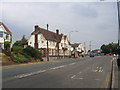
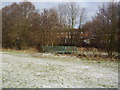
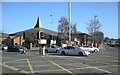

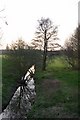
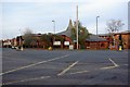
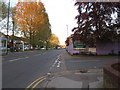
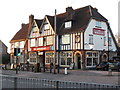
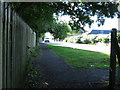
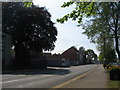
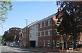
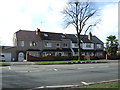
55 photos from this area
Area Information
Key information about the CV5 8GJ including its size, population, and administrative classification.
- Area Type
- Postcode
- Area Size
- 1.8 hectares
- Population
- 1430
- Population Density
- 4245 people/km²
House Prices in CV5 8GJ
48
Properties
£187,304
Average Sold Price
£55,000
Lowest Price
£295,000
Highest Price
Showing 48 properties
| Address | Type | Beds | Baths | Last Sale Price | Last Sale Date | |
|---|---|---|---|---|---|---|
| 214 Allesley Old Road, Coventry, CV5 8GJ | house | - | - | £295,000 | Jul 2025 | |
| 170 Allesley Old Road, Coventry, CV5 8GJ | Terraced | 6 | 2 | £152,500 | Feb 2025 | |
| 238 Allesley Old Road, Coventry, CV5 8GJ | Terraced | 3 | 2 | £285,000 | Aug 2024 | |
| 206 Allesley Old Road, Coventry, CV5 8GJ | Retail | 3 | 1 | £282,000 | Oct 2022 | |
| 166 Allesley Old Road, Coventry, CV5 8GJ | Retail | 2 | 1 | £189,000 | Jul 2022 | |
| 246 Allesley Old Road, Coventry, CV5 8GJ | house | - | - | £254,000 | Jun 2022 | |
| 168 Allesley Old Road, Coventry, CV5 8GJ | Terraced | 2 | 1 | £155,450 | May 2022 | |
| 224 Allesley Old Road, Coventry, CV5 8GJ | Terraced | - | - | £251,000 | Oct 2021 | |
| 208 Allesley Old Road, Coventry, CV5 8GJ | Terraced | 3 | 1 | £222,000 | Aug 2020 | |
| 192 Allesley Old Road, Coventry, CV5 8GJ | Terraced | 3 | 1 | £185,000 | May 2020 |
Page 1 of 5
Energy Efficiency in CV5 8GJ
Amenities
Schools
| Rank | School | Type | Entry gender | Ages |
|---|
Explore more schools in this area
Go to Schools tabDemographics
Household Size
Family (3-5 people)
most common
Accommodation Type
Houses
most common
Tenure
77
majority
Ethnic Group
White
most common
Religion
N/A
most common
Household Composition
N/A
most common
Age
47
median
Adults (30-64 years)
most common
Household Deprivation
N/A
with no deprivation
NS-SEC
35
in Lower managerial occupations
Explore more demographic insights in this area
Go to Demographics tabPlanning
Planning Constraints
- Flood RiskPremium
- Ramsar Wetland SitesPremium
- Area of Outstanding Natural BeautyPremium
- Protected Nature ReservePremium
- Protected WoodlandPremium