Area Overview for CV5 8BX
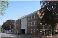
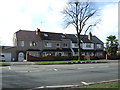
Photos of CV5 8BX


Area Information
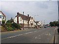
CV5 8BX is a compact residential postcode in England, covering just 2.9 hectares with a population of 1,882 people. This density means the area is tightly knit, with a high concentration of homes and residents. The community is predominantly middle-aged, with a median age of 47 and most residents falling between 30 and 64 years old. Over two-thirds of households are owner-occupied, reflecting a stable, long-term presence in the area. The postcode is part of Sherbourne Ward, historically shaped by the River Sherbourne, which once acted as a natural boundary. Today, the area’s small footprint means daily life is characterised by proximity to local amenities, schools, and transport links. While the population is relatively small, the area’s density fosters a close-knit community feel. The presence of multiple primary schools and nearby retail hubs suggests a focus on family living. However, the high population density also means limited space for expansion, making this a defined, self-contained neighbourhood with a distinct identity.
- Area Type
- Postcode
- Area Size
- 2.9 hectares
- Population
- 1882
- Population Density
- 3695 people/km²
The property market in CV5 8BX is dominated by owner-occupied homes, with 63% of residents owning their properties. This suggests a stable market where long-term residency is common, reducing turnover and fostering community continuity. The accommodation type is primarily houses, which contrasts with areas where flats or apartments predominate. This housing stock likely appeals to families seeking space and privacy, though the small area size means competition for properties is intense. The high home ownership rate also indicates a strong local economy, with residents less likely to move frequently. For buyers, this means a limited inventory of available homes, particularly in a small postcode like CV5 8BX. The focus on houses may also mean fewer rental options, making the area less accessible for those requiring short-term or flexible housing.
House Prices in CV5 8BX
Showing 3 properties
| Address | Type | Beds | Baths | Last Sale Price | Last Sale Date | |
|---|---|---|---|---|---|---|
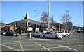
| Costa Express, Morrisons Petrol Filling Station, Holyhead Road, Coventry, CV5 8BX | shop | - | - | - | - | |
| Photo Me Booth At Morrisons Supermarket, Alvis Retail Park, Holyhead Road, Coventry, CV5 8BX | shop | - | - | - | - | |
| Morrisons Pharmacy, Pharmacy, Alvis Retail Park, Holyhead Road, Coventry, CV5 8BX | retail_financial | - | - | - | - |
Energy Efficiency in CV5 8BX
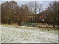
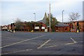
Residents of CV5 8BX have access to a range of amenities within practical reach. The area’s retail sector includes major chains like Morrisons, Aldi, and Tesco, offering convenience for daily shopping. Five rail stations provide easy access to nearby towns and cities, supporting both commuting and leisure travel. The presence of two airports, though not named distinctly, suggests proximity to regional transport networks. While specific parks or leisure facilities are not listed, the historical River Sherbourne may offer informal recreational spaces. The combination of retail, transport, and proximity to larger urban centres like Coventry creates a lifestyle that balances local convenience with regional connectivity. However, the small area size means amenities are concentrated, requiring residents to navigate a compact environment.
Amenities
Schools
Residents of CV5 8BX have access to three primary schools: Moseley Primary School, Moseley Infant School, and Moseley Junior School. Moseley Primary School holds a ‘good’ Ofsted rating, while the other two schools do not have ratings listed. The presence of three primary schools within the area suggests a strong focus on education, particularly for younger families. The mix of infant and junior schools provides a seamless transition for children, reducing the need for travel to other areas. However, the absence of secondary school data means families may need to look beyond CV5 8BX for secondary education. The proximity of multiple schools also implies a high demand for local education, which could influence property values and community dynamics.
| Rank | School | Type | Entry gender | Ages |
|---|
Explore more schools in this area
Go to Schools tabDemographics
The population of CV5 8BX is 1,882, with a median age of 47, indicating a mature demographic. The majority of residents are adults aged 30–64, reflecting a community with strong family ties and established careers. Home ownership is high at 63%, suggesting a preference for long-term residency over renting. The predominant accommodation type is houses, which aligns with the area’s residential character. Ethnically, the population is predominantly White, with no specific data on other groups provided. The age profile suggests a stable, low-turnover community, though the absence of younger residents may impact local schools and amenities. The high home ownership rate also implies a degree of economic stability, with residents likely invested in the area’s future. However, the lack of diversity data means the full demographic picture remains incomplete.
Household Size
Accommodation Type
Tenure
Ethnic Group
Religion
Household Composition
Age
Household Deprivation
NS-SEC
Explore more demographic insights in this area
Go to Demographics tabPlanning
Planning Constraints
- Flood RiskPremium
- Ramsar Wetland SitesPremium
- Area of Outstanding Natural BeautyPremium
- Protected Nature ReservePremium
- Protected WoodlandPremium