Area Overview for CV5 7ZF
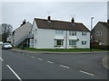
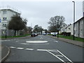
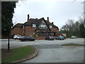
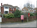
Photos of CV5 7ZF

Area Information
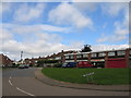
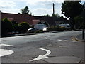
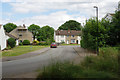
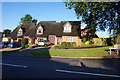
CV5 7ZF is a small residential postcode area in Coventry, part of the Woodlands Ward, with a population of 1,438. It sits within the historic city of Coventry, known for its medieval cloth and wool industries. The area is characterised by a tight-knit community, with most residents aged between 30 and 64, reflecting a mature demographic. Home ownership is high at 84%, with houses being the predominant type of accommodation. The area is not densely populated, offering a quieter, suburban feel. Nearby, Woodlands School—a heritage-listed comprehensive school—anchors the local identity, a legacy of post-war educational innovation. Daily life here balances proximity to essential services with a sense of stability. The postcode’s small size means residents are likely to know their neighbours, and the area’s low crime risk and excellent broadband connectivity support both practical living and modern needs. For those seeking a settled, family-oriented environment with historical roots, CV5 7ZF provides a blend of tradition and contemporary convenience.
- Area Type
- Postcode
- Area Size
- Not available
- Population
- 1438
- Population Density
- 4858 people/km²
The property market in CV5 7ZF is dominated by owner-occupied homes, with 84% of properties owned by residents rather than rented. This high home ownership rate suggests a stable market with long-term residents and limited turnover. The area is primarily composed of houses, which may indicate a more spread-out, low-density housing stock typical of suburban settings. Given the small size of the postcode, the housing stock is likely limited, making the area a niche market for buyers seeking established properties. The proximity to Woodlands School and rail stations may enhance property appeal, particularly for families. However, the limited size of the area means buyers should consider nearby zones for more options. The focus on owner-occupation suggests a community prioritising permanence over rental flexibility, which could influence local property values and development trends.
House Prices in CV5 7ZF
No properties found in this postcode.
Energy Efficiency in CV5 7ZF
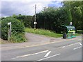
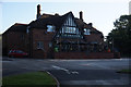
Residents of CV5 7ZF have access to a range of nearby amenities, including five retail outlets such as Co-op Sutherland, Budgens Jardine, and Farmfoods Allesley, which provide essential shopping and grocery services. The area’s rail connectivity, with five stations including Tile Hill and Berkswell, ensures convenient access to public transport for commuting or leisure. While no specific parks or leisure facilities are listed, the proximity to Woodlands School and the historical significance of the ward suggest a community with cultural and educational offerings. The presence of multiple retail options and rail links supports a practical lifestyle, allowing residents to meet daily needs without long commutes. The small postcode size means amenities are likely clustered closely, enhancing convenience. For those prioritising accessibility and essential services, CV5 7ZF offers a functional environment with a focus on practicality over sprawling urban sprawl.
Amenities
Schools
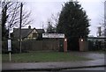
The nearest school to CV5 7ZF is Park Hill Primary School, which serves the local community with a good Ofsted rating. This primary school is a key institution for families in the area, offering a reliable educational foundation for younger children. While no secondary schools are listed in the immediate vicinity, the presence of a well-rated primary school suggests that the area is well-served for early education. The school’s good rating indicates a focus on quality teaching and student outcomes, which is crucial for parents prioritising education. Families with children may need to look slightly beyond the postcode for secondary schooling, but the proximity of Park Hill Primary ensures that younger children can access a strong local school. This makes CV5 7ZF an attractive option for those seeking a family-friendly environment with accessible primary education.
| Rank | School | Type | Entry gender | Ages |
|---|---|---|---|---|
| 1 | Park Hill Primary School | primary | N/A | N/A |
Explore more schools in this area
Go to Schools tabDemographics
The population of CV5 7ZF is 1,438, with a median age of 47. The majority of residents fall within the 30-64 age range, indicating a community of middle-aged and older adults. Home ownership is high at 84%, suggesting a stable, long-term resident base. The area is predominantly composed of houses, reflecting a suburban or semi-rural character. The predominant ethnic group is White, with no specific data on diversity or minority representation. This demographic profile points to a community with established roots, where families and individuals prioritise property ownership and long-term residency. The age distribution implies a population with experience and potentially fewer young dependents, which may influence local services and amenities. The absence of detailed diversity metrics means the area’s social fabric is largely defined by its majority demographic.
Household Size
Accommodation Type
Tenure
Ethnic Group
Religion
Household Composition
Age
Household Deprivation
NS-SEC
Explore more demographic insights in this area
Go to Demographics tabPlanning
Planning Constraints
- Flood RiskPremium
- Ramsar Wetland SitesPremium
- Area of Outstanding Natural BeautyPremium
- Protected Nature ReservePremium
- Protected WoodlandPremium
- Crime RiskPremium