Area Overview for CV5 7RH
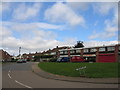
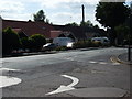
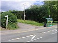
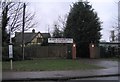
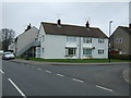
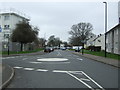
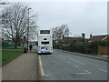
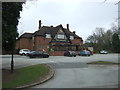
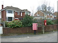
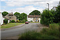
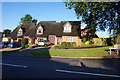
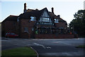
Photos of CV5 7RH
Area Information
CV5 7RH is a small residential postcode area in Coventry, England, home to 1,438 people. Situated within the Woodlands Ward, it lies in a historically significant part of the city, once a hub for the cloth and wool industries. The area’s compact size fosters a close-knit community, with a population skewed toward adults aged 30–64. Daily life here is characterised by a mix of quiet residential streets and proximity to local amenities. The ward’s heritage is evident in landmarks like Woodlands School, a pioneering 1950s comprehensive built using prefabricated designs. Residents benefit from easy access to rail networks, with Tile Hill, Canley, and Berkswell stations within reach, and broadband connectivity rated at the highest possible score. This blend of historical roots, practical infrastructure, and low crime rates makes CV5 7RH an appealing choice for those seeking a stable, family-oriented environment.
- Area Type
- Postcode
- Area Size
- Not available
- Population
- 1438
- Population Density
- 4858 people/km²
CV5 7RH is primarily an owner-occupied area, with 84% of homes owned by residents rather than rented. The accommodation type is predominantly houses, which suggests a focus on family homes and more spacious properties. This contrasts with areas dominated by flats or rental units, indicating a quieter, more established residential character. The small size of the postcode area means the housing stock is limited, but the high home ownership rate suggests strong local demand. Buyers should consider that the market is likely to be competitive, with properties reflecting the needs of older households and families. The absence of significant planning constraints or environmental risks further supports the area’s appeal for long-term ownership.
House Prices in CV5 7RH
No properties found in this postcode.
Energy Efficiency in CV5 7RH
The lifestyle in CV5 7RH is supported by a range of nearby amenities. Retail options include Co-op Sutherland, Budgens Jardine, and Farmfoods Allesley, offering everyday shopping needs within practical reach. The rail stations at Tile Hill, Canley, and Berkswell provide access to broader regional networks, while the proximity to Coventry Airport adds to the area’s connectivity. Though the data does not specify parks or leisure facilities, the absence of planning constraints suggests open spaces may be available nearby. The combination of retail, transport, and accessibility to larger urban centres creates a balanced lifestyle, blending local convenience with opportunities for travel and exploration.
Amenities
Schools
The nearest school to CV5 7RH is Park Hill Primary School, which has an Ofsted rating of ‘good’. This school serves the local community with primary education, offering a reliable option for families with young children. While no secondary schools are listed in the immediate vicinity, the presence of a well-rated primary school suggests that the area is family-friendly and prioritises education. The lack of additional schools nearby may mean that students require transport to secondary institutions in surrounding areas, but the strong rating at Park Hill Primary indicates a solid foundation for early learning.
| Rank | School | Type | Entry gender | Ages |
|---|---|---|---|---|
| 1 | Park Hill Primary School | primary | N/A | N/A |
Explore more schools in this area
Go to Schools tabDemographics
The population of CV5 7RH has a median age of 47, with the majority of residents falling within the 30–64 age range. This suggests a mature, established community with a strong presence of middle-aged households. Home ownership is high at 84%, indicating a predominantly owner-occupied area rather than a rental market. The accommodation type is largely houses, which aligns with the demographic profile of families and individuals seeking more spacious living. The predominant ethnic group is White, reflecting the broader demographic trends in the region. While specific data on deprivation is not provided, the high home ownership and low crime risk (91/100) imply a relatively stable and low-pressure environment for residents.
Household Size
Accommodation Type
Tenure
Ethnic Group
Religion
Household Composition
Age
Household Deprivation
NS-SEC
Explore more demographic insights in this area
Go to Demographics tabPlanning
Planning Constraints
- Flood RiskPremium
- Ramsar Wetland SitesPremium
- Area of Outstanding Natural BeautyPremium
- Protected Nature ReservePremium
- Protected WoodlandPremium
- Crime RiskPremium