Area Overview for CV5 7QR
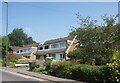
Photos of CV5 7QR


Area Information
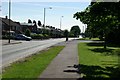
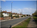
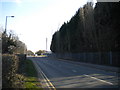
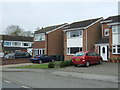
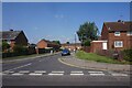
CV5 7QR is a small residential postcode area in Coventry, England, home to 2,045 people. It is a tightly knit cluster of homes, predominantly owner-occupied, with 82% of properties owned by residents. The area’s character is shaped by its history as part of the Woodlands Ward, a district with roots in Coventry’s medieval cloth and wool industries. Today, the community is marked by its stability, with a median age of 47 and a majority of residents aged 30–64. Daily life here is defined by proximity to local amenities, including schools, rail links, and retail hubs. The area’s low crime risk and absence of environmental constraints such as flood zones or protected landscapes make it a practical choice for families and professionals. Living in CV5 7QR offers a balance of convenience and quietude, with homes primarily in traditional house styles. Its location within Coventry provides access to the city’s cultural and economic resources while retaining a distinct local identity. For buyers, this area represents a compact, well-serviced community with clear advantages in safety and infrastructure.
- Area Type
- Postcode
- Area Size
- Not available
- Population
- 2045
- Population Density
- 3070 people/km²
The property market in CV5 7QR is dominated by owner-occupied homes, with 82% of properties owned by residents rather than rented. This suggests a stable market where long-term residency is common. The accommodation type is primarily houses, which are typically larger and suited to family living. Given the area’s small size and the prevalence of owner-occupied housing, the market is likely limited in scale but may offer consistent value retention. Buyers should consider that the housing stock is not diverse in type, with few flats or newer developments. The area’s proximity to rail links and schools adds to its appeal for families, though the small size of CV5 7QR means properties may be in high demand. For those seeking a traditional, low-maintenance home in a secure area, this postcode offers a focused option, though competition for available properties could be intense.
House Prices in CV5 7QR
No properties found in this postcode.
Energy Efficiency in CV5 7QR
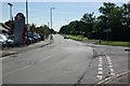
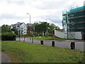
The lifestyle in CV5 7QR is supported by a range of nearby amenities, including five retail outlets such as Spar, Farmfoods Allesley, and Budgens Jardine. These shops provide essential grocery and convenience services, reducing the need for long trips to larger centres. The area’s rail links, including Tile Hill, Canley, and Berkswell stations, offer easy access to Coventry’s cultural and commercial hubs. While the postcode lacks major parks or leisure facilities, its proximity to Coventry’s historic and modern amenities—such as the city’s museums, markets, and transport networks—enriches daily life. The presence of two airports, though not specified for commercial use, may offer travel convenience. Overall, the area’s amenities balance practicality with accessibility, ensuring residents can meet daily needs without significant effort. The compact nature of CV5 7QR means that most services are within walking or short driving distance, fostering a sense of community and convenience.
Amenities
Schools
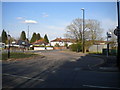
The Woodlands School, a primary school, and Woodlands Academy, an academy, are the key educational institutions near CV5 7QR. Both are located within the area’s immediate vicinity, providing families with options for early and secondary education. The Woodlands School, established in 1954, is notable for its prefabricated design and historical significance as one of the first purpose-built comprehensive schools in the UK. Woodlands Academy, as an academy, may offer a broader curriculum or specialist focus, though specific Ofsted ratings are not provided. The presence of two schools in close proximity ensures that residents have access to both primary and secondary education without long commutes. For families prioritising school quality, the mix of school types allows for choices between traditional and academically focused institutions, though prospective buyers should verify current performance metrics independently.
| Rank | School | Type | Entry gender | Ages |
|---|
Explore more schools in this area
Go to Schools tabDemographics
The population of CV5 7QR is 2,045, with a median age of 47, reflecting a mature demographic profile. The most common age range is adults aged 30–64, indicating a community centred on middle-aged households. Home ownership is high at 82%, suggesting a stable, long-term resident base. The accommodation type is predominantly houses, which aligns with the area’s traditional residential character. The predominant ethnic group is White, which is typical for this part of Coventry. This demographic makeup implies a community with established roots, where many residents have lived for years or generations. The absence of significant deprivation data means the area likely benefits from consistent access to services and employment. For buyers, this profile suggests a neighbourhood with a focus on family living and long-term investment, though the lack of diversity in age and background may be a consideration for those seeking a more varied community.
Household Size
Accommodation Type
Tenure
Ethnic Group
Religion
Household Composition
Age
Household Deprivation
NS-SEC
Explore more demographic insights in this area
Go to Demographics tabPlanning
Planning Constraints
- Flood RiskPremium
- Ramsar Wetland SitesPremium
- Area of Outstanding Natural BeautyPremium
- Protected Nature ReservePremium
- Protected WoodlandPremium