Area Overview for CV5 7PG
Photos of CV5 7PG
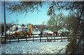
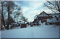
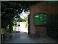
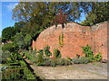
76 photos from this area
Area Information
Key information about the CV5 7PG including its size, population, and administrative classification.
- Area Type
- Postcode
- Area Size
- 1.0 hectares
- Population
- 1418
- Population Density
- 3987 people/km²
House Prices in CV5 7PG
16
Properties
£260,814
Average Sold Price
£145,500
Lowest Price
£390,000
Highest Price
Showing 16 properties
| Address | Type | Beds | Baths | Last Sale Price | Last Sale Date | |
|---|---|---|---|---|---|---|
| 26 Parkhill Drive, Coventry, CV5 7PG | house | - | - | £347,500 | Jun 2022 | |
| 10 Parkhill Drive, Coventry, CV5 7PG | house | 4 | - | £390,000 | May 2021 | |
| 14 Parkhill Drive, Coventry, CV5 7PG | Detached | 4 | 1 | £343,000 | Sep 2017 | |
| 32 Parkhill Drive, Coventry, CV5 7PG | Detached | 4 | 2 | £370,000 | Oct 2016 | |
| 20 Parkhill Drive, Coventry, CV5 7PG | Detached | 4 | 1 | £258,000 | Sep 2015 | |
| 30 Parkhill Drive, Coventry, CV5 7PG | house | - | - | £185,000 | Dec 2013 | |
| 4 Parkhill Drive, Coventry, CV5 7PG | house | - | - | £250,000 | Feb 2010 | |
| 6 Parkhill Drive, Coventry, CV5 7PG | Detached | - | - | £175,000 | Jun 2009 | |
| 28 Parkhill Drive, Coventry, CV5 7PG | Semi-detached | - | - | £179,950 | Jun 2009 | |
| 22 Parkhill Drive, Coventry, CV5 7PG | Detached | - | - | £225,000 | Jan 2005 |
Page 1 of 2
Energy Efficiency in CV5 7PG
Amenities
Schools
| Rank | School | Type | Entry gender | Ages |
|---|
Explore more schools in this area
Go to Schools tabDemographics
Household Size
Two person
most common
Accommodation Type
Houses
most common
Tenure
88
majority
Ethnic Group
White
most common
Religion
N/A
most common
Household Composition
N/A
most common
Age
47
median
Adults (30-64 years)
most common
Household Deprivation
N/A
with no deprivation
NS-SEC
42
in Lower managerial occupations
Explore more demographic insights in this area
Go to Demographics tabPlanning
Planning Constraints
- Flood RiskPremium
- Ramsar Wetland SitesPremium
- Area of Outstanding Natural BeautyPremium
- Protected Nature ReservePremium
- Protected WoodlandPremium