Area Overview for CV5 7LS
Photos of CV5 7LS
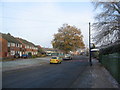

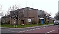
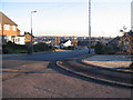
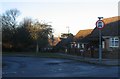
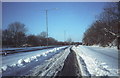
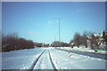
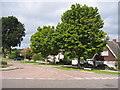
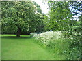
73 photos from this area
Area Information
Key information about the CV5 7LS including its size, population, and administrative classification.
- Area Type
- Postcode
- Area Size
- 3900 m²
- Population
- 1438
- Population Density
- 4858 people/km²
House Prices in CV5 7LS
15
Properties
£115,580
Average Sold Price
£44,000
Lowest Price
£177,000
Highest Price
Showing 15 properties
| Address | Type | Beds | Baths | Last Sale Price | Last Sale Date | |
|---|---|---|---|---|---|---|
| 5 Shetland Close, Coventry, CV5 7LS | Terraced | 3 | 1 | £168,000 | Nov 2021 | |
| 14 Shetland Close, Coventry, CV5 7LS | Terraced | 3 | 1 | £177,000 | May 2019 | |
| 1 Shetland Close, Coventry, CV5 7LS | Terraced | 3 | 1 | £165,000 | Jun 2018 | |
| 15 Shetland Close, Coventry, CV5 7LS | house | - | - | £121,904 | Jun 2014 | |
| 11 Shetland Close, Coventry, CV5 7LS | Terraced | 3 | 1 | £130,000 | Aug 2009 | |
| 12 Shetland Close, Coventry, CV5 7LS | house | - | - | £105,000 | Mar 2009 | |
| 3 Shetland Close, Coventry, CV5 7LS | house | - | - | £134,950 | Mar 2007 | |
| 16 Shetland Close, Coventry, CV5 7LS | house | - | - | £59,950 | Feb 2000 | |
| 9 Shetland Close, Coventry, CV5 7LS | Terraced | - | - | £50,000 | Jul 1997 | |
| 7 Shetland Close, Coventry, CV5 7LS | Terraced | - | - | £44,000 | Aug 1995 |
Page 1 of 2
Energy Efficiency in CV5 7LS
Amenities
Schools
| Rank | School | Type | Entry gender | Ages |
|---|
Explore more schools in this area
Go to Schools tabDemographics
Household Size
Two person
most common
Accommodation Type
Houses
most common
Tenure
84
majority
Ethnic Group
White
most common
Religion
N/A
most common
Household Composition
N/A
most common
Age
47
median
Adults (30-64 years)
most common
Household Deprivation
N/A
with no deprivation
NS-SEC
35
in Lower managerial occupations
Explore more demographic insights in this area
Go to Demographics tabPlanning
Planning Constraints
- Flood RiskPremium
- Ramsar Wetland SitesPremium
- Area of Outstanding Natural BeautyPremium
- Protected Nature ReservePremium
- Protected WoodlandPremium