Area Overview for CV5 6RH
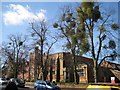
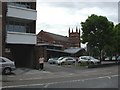
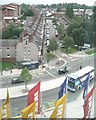
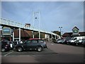
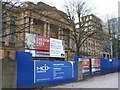
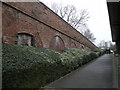
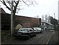
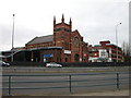
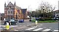
Photos of CV5 6RH


Area Information
CV5 6RH is a small residential postcode cluster in Coventry, England, with a population of 1,461. It lies west of central Coventry, near the modern by-pass, and historically included areas like Hearsall Common, now partially developed into housing estates and playing fields. The area is characterised by a young demographic, with a median age of 22 and the majority of residents aged 15–29. Daily life here is shaped by proximity to local amenities, including five retail outlets such as Aldi and Iceland, and five railway stations, including Canley and Tile Hill, which connect to Coventry and beyond. The area’s compact size means residents can access essential services within short distances. While the community is small, it is served by two schools—Hearsall Community Primary School and Hearsall Community Academy, the latter rated ‘good’ by Ofsted. The area’s history includes medieval roots and 19th-century urban expansion, though modern development now dominates. Living in CV5 6RH offers a mix of practicality and accessibility, though the young population suggests a dynamic, evolving community.
- Area Type
- Postcode
- Area Size
- Not available
- Population
- 1461
- Population Density
- 5220 people/km²
The property market in CV5 6RH is defined by a 41% home ownership rate, indicating that nearly half of residents live in owner-occupied homes, while the remaining properties are likely rented. The accommodation type is predominantly houses, which is unusual in urban areas but aligns with the area’s historical development as a residential cluster. This suggests a mix of older, established homes and newer builds, though the small population size means the market is limited in scale. For buyers, the area’s compact nature means properties are likely to be in close proximity to each other, with limited scope for large-scale development. The housing stock may appeal to first-time buyers or those seeking a quiet, family-oriented environment, given the nearby schools and transport links. However, the low home ownership percentage also implies a reliance on rental properties, which could affect long-term stability for residents. The market’s character is shaped by its small size and the dominance of single-family homes.
House Prices in CV5 6RH
Showing 66 properties
Energy Efficiency in CV5 6RH
Residents of CV5 6RH have access to a range of amenities within short distances, including five retail outlets such as Aldi, Iceland, and the Heart of England Co-operative Co. These shops provide convenience for daily shopping, though the selection may be limited compared to larger urban centres. The area’s rail network, with stations like Canley and Tile Hill, offers easy access to Coventry’s cultural and commercial hubs, as well as further afield. Nearby, Coventry Airport is listed twice in the data, though its specific role in local life is not detailed. The area’s small size means leisure options are concentrated, with parks and open spaces likely limited to nearby Hearsall Common or playing fields. The presence of schools and retail suggests a community-oriented lifestyle, where daily needs can be met locally. While the area lacks large-scale entertainment venues, its proximity to Coventry ensures residents can access theatres, museums, and other amenities in the city. The convenience of nearby services makes CV5 6RH practical for those prioritising accessibility over expansive leisure options.
Amenities
Schools
Residents of CV5 6RH have access to two schools: Hearsall Community Primary School, which serves younger children, and Hearsall Community Academy, a secondary school rated ‘good’ by Ofsted. The combination of a primary and academy school offers a comprehensive educational pathway for families. Hearsall Community Academy’s ‘good’ rating suggests it meets national standards in teaching quality and student outcomes, though specific performance metrics are not provided. The proximity of both schools to the area means parents can avoid long commutes, which is a significant advantage for families. The presence of a secondary school rated ‘good’ adds value to the area, as it reduces the need for students to attend schools further afield. However, the absence of additional schools or nurseries means families may need to look beyond CV5 6RH for early years education or specialist provisions. The school mix reflects a focus on local education infrastructure, which is crucial for young families considering the area.
| Rank | School | Type | Entry gender | Ages |
|---|
Explore more schools in this area
Go to Schools tabDemographics
The population of CV5 6RH is predominantly young adults, with a median age of 22 and 41% of residents owning their homes. The area is largely composed of houses, reflecting a lower proportion of rental properties compared to other parts of Coventry. The predominant ethnic group is White, though specific diversity metrics are not provided. The low median age indicates a community focused on early career stages, possibly linked to nearby employment opportunities or educational institutions. With 41% home ownership, the area leans towards owner-occupied housing, though the small population size suggests a limited property market. The absence of detailed deprivation data means quality-of-life factors such as income levels or access to services cannot be quantified here. However, the presence of schools, retail, and transport links implies a functional infrastructure for this age group. The demographic profile suggests a community in transition, with potential for growth or change as residents move through different life stages.
Household Size
Accommodation Type
Tenure
Ethnic Group
Religion
Household Composition
Age
Household Deprivation
NS-SEC
Explore more demographic insights in this area
Go to Demographics tabPlanning
Planning Constraints
- Flood RiskPremium
- Ramsar Wetland SitesPremium
- Area of Outstanding Natural BeautyPremium
- Protected Nature ReservePremium
- Protected WoodlandPremium