Area Overview for CV5 6RD
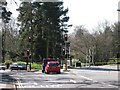
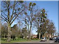
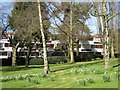
Photos of CV5 6RD


Area Information
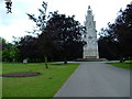
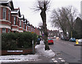
CV5 6RD is a small, tightly knit residential cluster nestled in the Earlsdon area of Coventry, just a mile southwest of the city centre. With a population of 1,408, it reflects the character of a suburban ward shaped by 19th-century planning. Originally developed as a garden village by Coventry watchmakers, the area retains echoes of its industrial heritage, including the Earlsdon Clock, a symbol of the watch-making trade that once defined the neighbourhood. Today, it balances historical charm with modern convenience, offering proximity to Coventry’s cultural and economic hubs while maintaining a quieter, community-focused atmosphere. The area’s compact size means residents enjoy a sense of familiarity, with local landmarks such as Spencer Park and King Henry VIII School forming the heart of daily life. Its strategic location near rail stations and airports makes it accessible for commuters, yet its low crime rate and flood risk-free status ensure a stable, secure living environment. For buyers, CV5 6RD represents a blend of heritage and practicality, ideal for those seeking a family-friendly, low-maintenance lifestyle in a historically rich part of the West Midlands.
- Area Type
- Postcode
- Area Size
- Not available
- Population
- 1408
- Population Density
- 7623 people/km²
The property market in CV5 6RD is characterised by a high rate of home ownership (69%) and a predominance of houses, reflecting a suburban, owner-occupied demographic. This suggests that the area is not primarily a rental market but rather one where residents have invested in long-term property. The focus on houses, as opposed to flats or apartments, indicates a preference for larger, more private homes, which may appeal to families or individuals seeking space and security. Given the area’s small size and compact residential cluster, the housing stock is limited, which could make the market competitive for buyers. However, the stability of the community and the absence of planning constraints (such as protected woodlands or AONB designations) may make it an attractive option for those seeking a low-maintenance, established property. The proximity to Coventry’s city centre and transport links further enhances its appeal, though buyers should consider the area’s limited expansion potential due to its small footprint.
House Prices in CV5 6RD
Showing 38 properties
Energy Efficiency in CV5 6RD
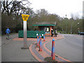
Living in CV5 6RD offers a mix of convenience and character, with nearby amenities that cater to daily needs. Retail options include the Heart of England Co-operative, Iceland Coventry, and Aldi, providing essential shopping within easy reach. The area’s rail connections to Canley, Tile Hill, and Coventry Arena stations make commuting straightforward, while the proximity to Coventry Airport adds flexibility for travel. For leisure, Spencer Park offers green space for recreation, and the historic King Henry VIII School, built in 1885, stands as a local landmark. The Earlsdon Clock, a community-funded symbol of the area’s watch-making heritage, adds a unique touch to the neighbourhood. Residents can enjoy a blend of practicality and heritage, with local pubs like the Royal Oak and historical sites such as St. Barbara’s Church contributing to a sense of community and continuity. The compact layout ensures that amenities are accessible without requiring long commutes, enhancing the overall quality of life.
Amenities
Schools
| Rank | School | Type | Entry gender | Ages |
|---|
Explore more schools in this area
Go to Schools tabDemographics
The demographic profile of CV5 6RD is defined by a median age of 47, with the majority of residents falling within the 30–64 age range. This suggests a mature, established community with a strong presence of middle-aged and older adults. Home ownership is high at 69%, indicating a stable, long-term resident base rather than a transient rental market. The predominant accommodation type is houses, which aligns with the area’s suburban character and suggests larger, family-oriented properties. The predominant ethnic group is White, reflecting the broader demographic trends of the region. While specific data on deprivation is not provided, the high home ownership rate and low crime score of 79 imply a relatively affluent and secure neighbourhood. The absence of significant demographic diversity data means the area’s social fabric remains largely homogeneous, which may appeal to buyers seeking a predictable, cohesive community. The age profile also suggests a population less reliant on schools and childcare services, though the presence of King Henry VIII School nearby caters to younger families.
Household Size
Accommodation Type
Tenure
Ethnic Group
Religion
Household Composition
Age
Household Deprivation
NS-SEC
Explore more demographic insights in this area
Go to Demographics tabPlanning
Planning Constraints
- Flood RiskPremium
- Ramsar Wetland SitesPremium
- Area of Outstanding Natural BeautyPremium
- Protected Nature ReservePremium
- Protected WoodlandPremium