Area Overview for CV5 6PR
Photos of CV5 6PR


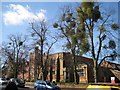

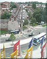
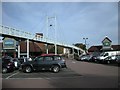

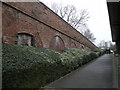
100 photos from this area
Area Information
Key information about the CV5 6PR including its size, population, and administrative classification.
- Area Type
- Postcode
- Area Size
- 3774 m²
- Population
- 1408
- Population Density
- 7623 people/km²
House Prices in CV5 6PR
22
Properties
£168,742
Average Sold Price
£82,500
Lowest Price
£435,400
Highest Price
Showing 22 properties
| Address | Type | Beds | Baths | Last Sale Price | Last Sale Date | |
|---|---|---|---|---|---|---|
| 1 Mayfield Road, Coventry, CV5 6PR | Semi-detached | 3 | 3 | £435,400 | Oct 2023 | |
| 37 Mayfield Road, Coventry, CV5 6PR | Terraced | 2 | - | £260,000 | Jun 2018 | |
| 19 Mayfield Road, Coventry, CV5 6PR | house | 2 | - | £160,000 | Dec 2012 | |
| 17 Mayfield Road, Coventry, CV5 6PR | Terraced | 2 | 1 | £135,000 | Apr 2011 | |
| 21 Mayfield Road, Coventry, CV5 6PR | house | 2 | - | £117,000 | Feb 2011 | |
| 39 Mayfield Road, Coventry, CV5 6PR | house | - | - | £160,000 | Jul 2009 | |
| 15 Mayfield Road, Coventry, CV5 6PR | Terraced | 2 | 1 | £156,000 | Jun 2006 | |
| 29 Mayfield Road, Coventry, CV5 6PR | Terraced | - | - | £163,000 | May 2006 | |
| 41 Mayfield Road, Coventry, CV5 6PR | Terraced | - | - | £124,000 | Sep 2004 | |
| 31 Mayfield Road, Coventry, CV5 6PR | Terraced | 3 | 1 | £140,000 | Aug 2004 |
Page 1 of 3
Energy Efficiency in CV5 6PR
Amenities
Schools
| Rank | School | Type | Entry gender | Ages |
|---|
Explore more schools in this area
Go to Schools tabDemographics
Household Size
Two person
most common
Accommodation Type
Houses
most common
Tenure
69
majority
Ethnic Group
White
most common
Religion
N/A
most common
Household Composition
N/A
most common
Age
47
median
Adults (30-64 years)
most common
Household Deprivation
N/A
with no deprivation
NS-SEC
52
in Lower managerial occupations
Explore more demographic insights in this area
Go to Demographics tabPlanning
Planning Constraints
- Flood RiskPremium
- Ramsar Wetland SitesPremium
- Area of Outstanding Natural BeautyPremium
- Protected Nature ReservePremium
- Protected WoodlandPremium