Area Overview for CV5 6NY
Photos of CV5 6NY

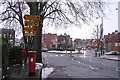
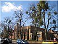
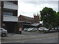
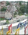
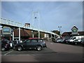
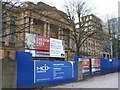
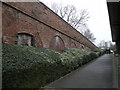
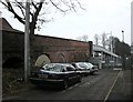
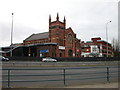
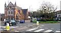
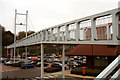
100 photos from this area
Area Information
Key information about the CV5 6NY including its size, population, and administrative classification.
- Area Type
- Postcode
- Area Size
- 5678 m²
- Population
- 1408
- Population Density
- 7623 people/km²
House Prices in CV5 6NY
33
Properties
£232,363
Average Sold Price
£57,000
Lowest Price
£375,000
Highest Price
Showing 33 properties
| Address | Type | Beds | Baths | Last Sale Price | Last Sale Date | |
|---|---|---|---|---|---|---|
| 13 Berkeley Road North, Coventry, CV5 6NY | Terraced | 3 | 1 | £307,500 | Nov 2025 | |
| 27 Berkeley Road North, Coventry, CV5 6NY | Flat | 2 | - | £175,000 | Jan 2025 | |
| 15 Berkeley Road North, Coventry, CV5 6NY | Terraced | 3 | 1 | £350,000 | Oct 2023 | |
| 49 Berkeley Road North, Coventry, CV5 6NY | house | - | - | £310,000 | Feb 2023 | |
| 51 Berkeley Road North, Coventry, CV5 6NY | house | - | - | £282,000 | Sep 2022 | |
| 61 Berkeley Road North, Coventry, CV5 6NY | Terraced | 3 | 1 | £375,000 | Sep 2021 | |
| 21 Berkeley Road North, Coventry, CV5 6NY | Terraced | 3 | 1 | £330,000 | Nov 2019 | |
| 47 Berkeley Road North, Coventry, CV5 6NY | Terraced | 3 | 2 | £370,000 | Aug 2019 | |
| 59 Berkeley Road North, Coventry, CV5 6NY | house | - | - | £280,000 | Sep 2018 | |
| 39 Berkeley Road North, Coventry, CV5 6NY | house | 4 | - | £332,000 | Sep 2017 |
Page 1 of 4
Energy Efficiency in CV5 6NY
Amenities
Schools
| Rank | School | Type | Entry gender | Ages |
|---|
Explore more schools in this area
Go to Schools tabDemographics
Household Size
Two person
most common
Accommodation Type
Houses
most common
Tenure
69
majority
Ethnic Group
White
most common
Religion
N/A
most common
Household Composition
N/A
most common
Age
47
median
Adults (30-64 years)
most common
Household Deprivation
N/A
with no deprivation
NS-SEC
52
in Lower managerial occupations
Explore more demographic insights in this area
Go to Demographics tabPlanning
Planning Constraints
- Flood RiskPremium
- Ramsar Wetland SitesPremium
- Area of Outstanding Natural BeautyPremium
- Protected Nature ReservePremium
- Protected WoodlandPremium