Area Overview for CV5 6JS
Photos of CV5 6JS

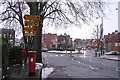
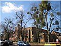
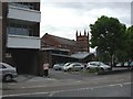
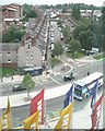
100 photos from this area
Area Information
Key information about the CV5 6JS including its size, population, and administrative classification.
- Area Type
- Postcode
- Area Size
- 2.0 hectares
- Population
- 1927
- Population Density
- 5337 people/km²
House Prices in CV5 6JS
31
Properties
£172,892
Average Sold Price
£33,300
Lowest Price
£247,000
Highest Price
Showing 31 properties
| Address | Type | Beds | Baths | Last Sale Price | Last Sale Date | |
|---|---|---|---|---|---|---|
| 48 Winifred Avenue, Coventry, CV5 6JS | house | - | - | £242,000 | Sep 2025 | |
| 20 Winifred Avenue, Coventry, CV5 6JS | house | - | - | £247,000 | Jul 2023 | |
| 38 Winifred Avenue, Coventry, CV5 6JS | house | - | - | £245,000 | Aug 2022 | |
| 36 Winifred Avenue, Coventry, CV5 6JS | house | - | - | £235,000 | Feb 2022 | |
| 26 Winifred Avenue, Coventry, CV5 6JS | Terraced | 3 | 1 | £205,000 | Feb 2021 | |
| 46 Winifred Avenue, Coventry, CV5 6JS | house | - | - | £185,000 | Nov 2020 | |
| 34 Winifred Avenue, Coventry, CV5 6JS | Terraced | 3 | - | £233,657 | Oct 2018 | |
| 22 Winifred Avenue, Coventry, CV5 6JS | house | - | - | £227,500 | May 2018 | |
| 18 Winifred Avenue, Coventry, CV5 6JS | house | 1 | 2 | £208,000 | Apr 2018 | |
| 58 Winifred Avenue, Coventry, CV5 6JS | Terraced | 3 | 1 | £170,000 | Nov 2016 |
Page 1 of 4
Energy Efficiency in CV5 6JS
Amenities
Schools
| Rank | School | Type | Entry gender | Ages |
|---|
Explore more schools in this area
Go to Schools tabDemographics
Household Size
One person
most common
Accommodation Type
Flats
most common
Tenure
21
majority
Ethnic Group
White
most common
Religion
N/A
most common
Household Composition
N/A
most common
Age
22
median
Young Adults (15-29 years)
most common
Household Deprivation
N/A
with no deprivation
NS-SEC
21
in Lower managerial occupations
Explore more demographic insights in this area
Go to Demographics tabPlanning
Planning Constraints
- Flood RiskPremium
- Ramsar Wetland SitesPremium
- Area of Outstanding Natural BeautyPremium
- Protected Nature ReservePremium
- Protected WoodlandPremium