Area Overview for CV5 6JD
Photos of CV5 6JD


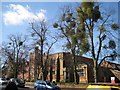

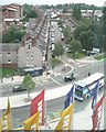
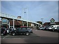

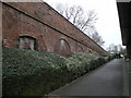
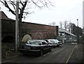
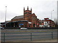
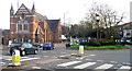
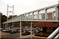
100 photos from this area
Area Information
Key information about the CV5 6JD including its size, population, and administrative classification.
- Area Type
- Postcode
- Area Size
- 3166 m²
- Population
- 1658
- Population Density
- 7438 people/km²
House Prices in CV5 6JD
19
Properties
£154,950
Average Sold Price
£87,500
Lowest Price
£212,000
Highest Price
Showing 19 properties
| Address | Type | Beds | Baths | Last Sale Price | Last Sale Date | |
|---|---|---|---|---|---|---|
| 134 Sovereign Road, Coventry, CV5 6JD | Terraced | 2 | 1 | £198,000 | Oct 2024 | |
| 138 Sovereign Road, Coventry, CV5 6JD | Terraced | 2 | 1 | £191,000 | Sep 2024 | |
| 114 Sovereign Road, Coventry, CV5 6JD | Terraced | 2 | 1 | £155,000 | Jul 2024 | |
| 110 Sovereign Road, Coventry, CV5 6JD | house | - | - | £181,500 | Nov 2022 | |
| 122 Sovereign Road, Coventry, CV5 6JD | house | - | - | £168,500 | Mar 2022 | |
| 124 Sovereign Road, Coventry, CV5 6JD | house | - | - | £212,000 | Jun 2021 | |
| 132 Sovereign Road, Coventry, CV5 6JD | Terraced | 2 | 1 | £175,000 | Feb 2021 | |
| 124A Sovereign Road, Coventry, CV5 6JD | Terraced | 2 | 1 | £170,000 | Oct 2019 | |
| 118 Sovereign Road, Coventry, CV5 6JD | house | 2 | 1 | £165,000 | Jun 2019 | |
| 120 Sovereign Road, Coventry, CV5 6JD | Terraced | 2 | 1 | £140,000 | Jun 2018 |
Page 1 of 2
Energy Efficiency in CV5 6JD
Amenities
Schools
| Rank | School | Type | Entry gender | Ages |
|---|
Explore more schools in this area
Go to Schools tabDemographics
Household Size
One person
most common
Accommodation Type
Houses
most common
Tenure
49
majority
Ethnic Group
White
most common
Religion
N/A
most common
Household Composition
N/A
most common
Age
47
median
Adults (30-64 years)
most common
Household Deprivation
N/A
with no deprivation
NS-SEC
30
in Lower managerial occupations
Explore more demographic insights in this area
Go to Demographics tabPlanning
Planning Constraints
- Flood RiskPremium
- Ramsar Wetland SitesPremium
- Area of Outstanding Natural BeautyPremium
- Protected Nature ReservePremium
- Protected WoodlandPremium