Area Overview for CV5 6FR
Photos of CV5 6FR
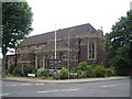
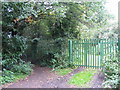
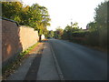

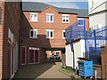
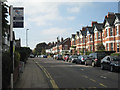
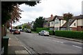
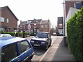
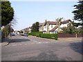
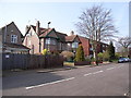
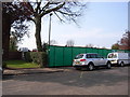
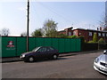
100 photos from this area
Area Information
Key information about the CV5 6FR including its size, population, and administrative classification.
- Area Type
- Postcode
- Area Size
- 6.0 hectares
- Population
- 1474
- Population Density
- 2059 people/km²
House Prices in CV5 6FR
40
Properties
£322,807
Average Sold Price
£90,000
Lowest Price
£577,000
Highest Price
Showing 40 properties
| Address | Type | Beds | Baths | Last Sale Price | Last Sale Date | |
|---|---|---|---|---|---|---|
| 161 Beechwood Avenue, Coventry, CV5 6FR | Semi-detached | 5 | 2 | £577,000 | Oct 2025 | |
| 173 Beechwood Avenue, Coventry, CV5 6FR | Semi-detached | 3 | 1 | £427,000 | Jan 2025 | |
| 177 Beechwood Avenue, Coventry, CV5 6FR | house | 4 | 2 | £485,000 | Nov 2022 | |
| 211 Beechwood Avenue, Coventry, CV5 6FR | house | 4 | - | £430,000 | Feb 2021 | |
| 159 Beechwood Avenue, Coventry, CV5 6FR | house | - | - | £475,000 | Apr 2018 | |
| 201 Beechwood Avenue, Coventry, CV5 6FR | house | - | - | £330,000 | Jun 2016 | |
| 171 Beechwood Avenue, Coventry, CV5 6FR | house | - | - | £375,000 | Jun 2016 | |
| 135 Beechwood Avenue, Coventry, CV5 6FR | Detached | 4 | - | £430,000 | Dec 2015 | |
| 187 Beechwood Avenue, Coventry, CV5 6FR | house | - | - | £350,000 | Feb 2015 | |
| 143 Beechwood Avenue, Coventry, CV5 6FR | house | 4 | - | £175,000 | Dec 2013 |
Page 1 of 4
Energy Efficiency in CV5 6FR
Amenities
Schools
| Rank | School | Type | Entry gender | Ages |
|---|
Explore more schools in this area
Go to Schools tabDemographics
Household Size
Two person
most common
Accommodation Type
Houses
most common
Tenure
86
majority
Ethnic Group
White
most common
Religion
N/A
most common
Household Composition
N/A
most common
Age
47
median
Adults (30-64 years)
most common
Household Deprivation
N/A
with no deprivation
NS-SEC
43
in Lower managerial occupations
Explore more demographic insights in this area
Go to Demographics tabPlanning
Planning Constraints
- Flood RiskPremium
- Ramsar Wetland SitesPremium
- Area of Outstanding Natural BeautyPremium
- Protected Nature ReservePremium
- Protected WoodlandPremium