Area Overview for CV5 6EL
Photos of CV5 6EL
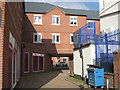
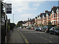
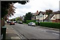
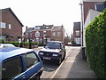
100 photos from this area
Area Information
Key information about the CV5 6EL including its size, population, and administrative classification.
- Area Type
- Postcode
- Area Size
- 4390 m²
- Population
- Not available
- Population Density
- Not available
House Prices in CV5 6EL
21
Properties
£253,606
Average Sold Price
£79,950
Lowest Price
£405,000
Highest Price
Showing 21 properties
| Address | Type | Beds | Baths | Last Sale Price | Last Sale Date | |
|---|---|---|---|---|---|---|
| 71 Earlsdon Street, Coventry, CV5 6EL | house | - | - | £405,000 | Mar 2022 | |
| 57 Earlsdon Street, Coventry, CV5 6EL | Terraced | 6 | 2 | £350,000 | Jan 2022 | |
| 59 Earlsdon Street, Coventry, CV5 6EL | Terraced | 5 | 2 | £315,000 | Nov 2020 | |
| 63 Earlsdon Street, Coventry, CV5 6EL | Terraced | 6 | 2 | £315,000 | Nov 2020 | |
| Flat Above, 47 Earlsdon Street, Coventry, CV5 6EL | Retail | - | - | £300,000 | Nov 2020 | |
| 75 Earlsdon Street, Coventry, CV5 6EL | Terraced | - | - | £280,000 | Jul 2005 | |
| 55 Earlsdon Street, Coventry, CV5 6EL | Unknown | - | - | £147,500 | Jul 2002 | |
| 67 Earlsdon Street, Coventry, CV5 6EL | Terraced | - | - | £90,000 | Mar 1999 | |
| 61 Earlsdon Street, Coventry, CV5 6EL | Terraced | - | - | £79,950 | Jun 1997 | |
| 73 Earlsdon Street, Coventry, CV5 6EL | Semi-detached | 4 | 2 | - | - |
Page 1 of 3
Energy Efficiency in CV5 6EL
Amenities
Schools
| Rank | School | Type | Entry gender | Ages |
|---|
Explore more schools in this area
Go to Schools tabDemographics
Household Size
One person
most common
Accommodation Type
Houses
most common
Tenure
57
majority
Ethnic Group
White
most common
Religion
N/A
most common
Household Composition
N/A
most common
Age
47
median
Adults (30-64 years)
most common
Household Deprivation
N/A
with no deprivation
NS-SEC
45
in Lower managerial occupations
Explore more demographic insights in this area
Go to Demographics tabPlanning
Planning Constraints
- Flood RiskPremium
- Ramsar Wetland SitesPremium
- Area of Outstanding Natural BeautyPremium
- Protected Nature ReservePremium
- Protected WoodlandPremium