Area Overview for CV5 6DA
Photos of CV5 6DA

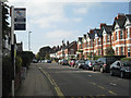
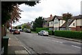
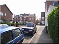
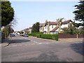
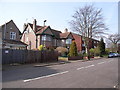
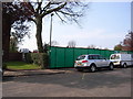
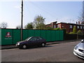
100 photos from this area
Area Information
Key information about the CV5 6DA including its size, population, and administrative classification.
- Area Type
- Postcode
- Area Size
- 1.3 hectares
- Population
- 1384
- Population Density
- 1317 people/km²
House Prices in CV5 6DA
34
Properties
£323,179
Average Sold Price
£73,000
Lowest Price
£575,000
Highest Price
Showing 34 properties
| Address | Type | Beds | Baths | Last Sale Price | Last Sale Date | |
|---|---|---|---|---|---|---|
| 35 Stoneleigh Avenue, Coventry, CV5 6DA | Semi-detached | 3 | 2 | £575,000 | Apr 2025 | |
| 69 Stoneleigh Avenue, Coventry, CV5 6DA | house | - | - | £520,000 | Jun 2023 | |
| 57 Stoneleigh Avenue, Coventry, CV5 6DA | house | 3 | - | £400,000 | Jun 2021 | |
| 47 Stoneleigh Avenue, Coventry, CV5 6DA | house | - | - | £535,000 | Jun 2021 | |
| 65 Stoneleigh Avenue, Coventry, CV5 6DA | house | - | - | £425,000 | Nov 2017 | |
| 13 Stoneleigh Avenue, Coventry, CV5 6DA | house | - | - | £390,000 | Sep 2017 | |
| 45 Stoneleigh Avenue, Coventry, CV5 6DA | Semi-detached | 4 | 1 | £420,000 | Aug 2017 | |
| 73 Stoneleigh Avenue, Coventry, CV5 6DA | Detached | 4 | 2 | £460,000 | Jul 2017 | |
| 41 Stoneleigh Avenue, Coventry, CV5 6DA | Semi-detached | 5 | 3 | £420,000 | Jul 2016 | |
| 51 Stoneleigh Avenue, Coventry, CV5 6DA | Semi-detached | 3 | 1 | £170,000 | Mar 2016 |
Page 1 of 4
Energy Efficiency in CV5 6DA
Amenities
Schools
| Rank | School | Type | Entry gender | Ages |
|---|
Explore more schools in this area
Go to Schools tabDemographics
Household Size
Two person
most common
Accommodation Type
Houses
most common
Tenure
94
majority
Ethnic Group
White
most common
Religion
N/A
most common
Household Composition
N/A
most common
Age
47
median
Adults (30-64 years)
most common
Household Deprivation
N/A
with no deprivation
NS-SEC
52
in Lower managerial occupations
Explore more demographic insights in this area
Go to Demographics tabPlanning
Planning Constraints
- Flood RiskPremium
- Ramsar Wetland SitesPremium
- Area of Outstanding Natural BeautyPremium
- Protected Nature ReservePremium
- Protected WoodlandPremium