Area Overview for CV47 2UL
Photos of CV47 2UL

Area Information
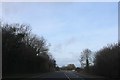
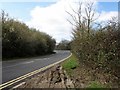
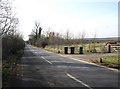
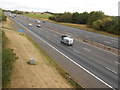
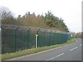
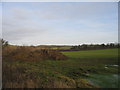
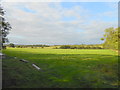
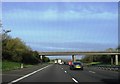
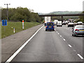
CV47 2UL is a small, tightly knit residential cluster in Warwickshire, nestled within the ancient parish of Burton Dassett. Covering 20.4 hectares, the area is home to 2,338 residents, giving it a low population density of 52 people per square kilometre. This quiet stretch of land lies on hilly terrain, with the nearby Burton Dassett Hills offering a glimpse into the region’s medieval past. The area’s character is shaped by its history as a 13th-century market town, though modern life here is more subdued, with a focus on family homes and community stability. Residents are predominantly adults aged 30–64, many of whom own their properties. The proximity to Fenny-Compton railway station, 2½ miles away, and the M40 motorway provides access to nearby towns, while the surrounding landscape retains a rural feel. With low crime rates and no major environmental risks, CV47 2UL offers a peaceful, low-maintenance lifestyle for those seeking a slower pace of life.
- Area Type
- Postcode
- Area Size
- 20.4 hectares
- Population
- 2338
- Population Density
- 52 people/km²
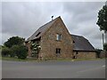
CV47 2UL is primarily an owner-occupied area, with 69% of properties owned by their residents. The housing stock is dominated by houses rather than flats, reflecting a preference for larger, more traditional homes. This aligns with the area’s low population density and the presence of family households. Given the small size of the postcode, the property market is likely limited to a handful of homes, with limited scope for new developments. Buyers should consider the proximity to nearby amenities, such as schools and retail outlets, which may influence property values. The high home ownership rate suggests a stable market, but the small size of the area means that buyers may need to look beyond CV47 2UL for a wider selection of properties. The focus on houses also implies that the area may appeal to those seeking space and privacy over high-density living.
House Prices in CV47 2UL
Showing 16 properties
Energy Efficiency in CV47 2UL
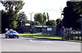
Residents of CV47 2UL have access to five retail outlets within practical reach, including Asda Gaydon, Heart of England Co-operative Co, and Co-op Kineton. These shops provide essential services, from groceries to general retail, supporting daily life in the area. The surrounding landscape, characterised by hilly terrain and historical sites such as All Saints Church, adds a unique cultural dimension to the neighbourhood. While no parks or leisure facilities are explicitly listed, the proximity to Burton Dassett Hills suggests opportunities for outdoor activities. The area’s small size means that amenities are concentrated, offering convenience for those who prefer a compact, self-contained lifestyle. The mix of retail options and historical landmarks creates a balance between modern convenience and traditional charm, appealing to those who value both practicality and heritage.
Amenities
Schools
The nearest schools to CV47 2UL include Northend Junior and Infant School and Temple Herdewyke Primary School, both of which are primary institutions. While no Ofsted ratings are provided, the presence of two primary schools suggests a focus on early education within the community. Families with young children may benefit from the proximity of these schools, though the lack of secondary schools in the immediate area could necessitate commuting to nearby towns. The duplication of Temple Herdewyke Primary School in the data may indicate a local emphasis on primary education, possibly serving multiple nearby settlements. For buyers prioritising schools, the availability of primary institutions is a key consideration, though further research into secondary education options would be necessary for long-term family needs.
| Rank | School | Type | Entry gender | Ages |
|---|
Explore more schools in this area
Go to Schools tabDemographics
The population of CV47 2UL is 2,338, with a median age of 47 and the majority of residents falling within the 30–64 age range. This suggests a community skewed towards middle-aged adults, likely including families and long-term residents. Home ownership is high, with 69% of properties owned by their occupants, indicating a stable, settled population. The area is dominated by houses rather than flats, reflecting a preference for traditional, family-friendly housing. The predominant ethnic group is White, though no specific data on diversity or deprivation levels is provided. The low population density of 52 people per square kilometre implies spacious living conditions and a lack of overcrowding. For buyers, this demographic profile suggests a community with established roots, where property values may be influenced by long-term residency and limited turnover.
Household Size
Accommodation Type
Tenure
Ethnic Group
Religion
Household Composition
Age
Household Deprivation
NS-SEC
Explore more demographic insights in this area
Go to Demographics tabPlanning
Planning Constraints
- Flood RiskPremium
- Ramsar Wetland SitesPremium
- Area of Outstanding Natural BeautyPremium
- Protected Nature ReservePremium
- Protected WoodlandPremium