Area Overview for CV47 0ET
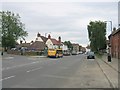
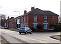
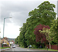
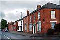
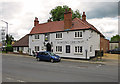
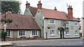
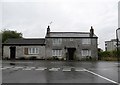
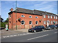
Photos of CV47 0ET


Area Information
Living in CV47 0ET offers a grounded experience within a historic and rural setting. This specific postcode area covers a small residential cluster measuring 7,231 m², hosting a population of 1,902 people. The location sits within Southam, a civil parish and historic market town in Warwickshire that lies along an ancient drover's route. The community benefits from proximity to notable landmarks such as the Grade I listed 14th-century parish church of St James and the early 16th-century Old Mint public house. Residents enjoy access to a bustling market square and the historic character of a town first mentioned as Sucham in the Domesday Book. The area size and population density create an intimate neighbourhood feel while maintaining connections to the wider Warwickshire countryside. Daily life here blends rural tranquility with the convenience of a market town. You can expect a quiet environment where the pace of life reflects the historic nature of the location. This setting provides a distinct alternative to urban living without sacrificing essential amenities or connectivity to the rest of England.
- Area Type
- Postcode
- Area Size
- 7231 m²
- Population
- 1902
- Population Density
- 1688 people/km²
Homes in CV47 0ET are characterised by a strong incumbent market where ownership outweighs renting. The accommodation type data confirms that houses dominate the landscape, making this postcode unsuitable for those seeking apartments or flats. With 62% of residents classified as homeowners, the property market reflects a shift towards long-term stability rather than short-term tenancies. This high level of owner occupancy often correlates with higher residential investment and a maintained housing stock. Buyers looking at this specific cluster of 7,231 m² will find that properties are likely occupied by families or adults seeking a contained, rural lifestyle. The concentration of house ownership suggests limited rental availability within the immediate postcode boundary. For homebuyers, this environment provides a predictable market with a focus on permanent residence. The nature of the housing stock implies that you are looking at established homes within a historic town rather than new developments or student lets. This structure supports a community where neighbours have been in place for extended periods.
House Prices in CV47 0ET
Showing 24 properties
| Address | Type | Beds | Baths | Last Sale Price | Last Sale Date | |
|---|---|---|---|---|---|---|
| 81 Mayfield Road, Southam, CV47 0ET | Terraced | 3 | 1 | £226,000 | Jul 2020 | |
| 107 Mayfield Road, Southam, CV47 0ET | Terraced | 3 | 1 | £182,500 | Oct 2015 | |
| 111 Mayfield Road, Southam, CV47 0ET | house | 3 | - | £118,000 | Sep 2012 | |
| 95 Mayfield Road, Southam, CV47 0ET | Terraced | 3 | 1 | £168,500 | Aug 2006 | |
| 91 Mayfield Road, Southam, CV47 0ET | Terraced | - | - | £152,000 | May 2006 | |
| 87 Mayfield Road, Southam, CV47 0ET | house | - | - | £128,000 | Mar 2003 | |
| 99 Mayfield Road, Southam, CV47 0ET | Terraced | - | - | £71,000 | Jun 2000 | |
| 105 Mayfield Road, Southam, CV47 0ET | Terraced | - | - | £70,000 | Jan 2000 | |
| 85 Mayfield Road, Southam, CV47 0ET | Terraced | - | - | £59,950 | Jan 1999 | |
| 83 Mayfield Road, Southam, CV47 0ET | house | - | - | - | - |
Energy Efficiency in CV47 0ET
Daily life in CV47 0ET provides essential amenities within practical reach of residents. The local area features a selection of retail options including Tesco Southam and two outlets of the Heart of England Co-operative Co. These venues form the backbone of local shopping, offering necessities for everyday household management. Beyond retail, the nearby landmarks such as Stoneythorpe Hall and Chesterton Windmill provide cultural and historical interest points for leisure time. The Southam Heritage Collection and the Holy Well offer further opportunities for exploration and connection with local history. As a rural market town nestled in the Warwickshire countryside, the lifestyle centres around the historic market square and a quaint, charming atmosphere. This setting supports a slower pace of life while maintaining access to quality goods. You can enjoy the convenience of local shops combined with the peace of the drover's route location. The combination of historic sites and practical retail creates a balanced environment for living and leisure.
Amenities
Schools
Family life for residents of CV47 0ET is supported by a cluster of primary education options located nearby. The nearest educational facilities include Southam Middle School, Southam First School, and Southam Primary School, which are all listed as primary institutions. These schools serve the local community and offer early years education close to home. While specific Ofsted ratings are not provided in the current data, the presence of multiple primary schools indicates a dedicated local education infrastructure suitable for young families. The fact that all listed facilities are primary schools suggests that secondary education options for older children lie at a greater distance from this specific postcode. Families with young children will find convenient access to schooling, ensuring that daily commutes to education are minimal. When choosing homes in CV47 0ET, you should consider the catchment areas of these primary schools alongside the community services available in the wider Southam market town.
| Rank | School | Type | Entry gender | Ages |
|---|
Explore more schools in this area
Go to Schools tabDemographics
The community in CV47 0ET consists primarily of adults aged between 30 and 64 years. The median age for residents is 47, indicating a stable, mature population less dominated by school-age children or retirees. Home ownership stands at 62%, which is significantly higher than national averages, suggesting most households have purchased their properties rather than renting. The predominant form of accommodation in this postcode is houses, reinforcing the family-oriented and established nature of the neighbourhood. The resident demographic is predominantly White, reflecting the broader trends of the Warwickshire region. With a population density of 1,688 people per km², the area offers a balance between community interaction and personal space. This age profile and high ownership rate indicate a settled population likely focused on stability and long-term living arrangements. Families and couples without dependent children form the core of the local demographic, contributing to a steady and reliable community atmosphere.
Household Size
Accommodation Type
Tenure
Ethnic Group
Religion
Household Composition
Age
Household Deprivation
NS-SEC
Explore more demographic insights in this area
Go to Demographics tabPlanning
Planning Constraints
- Flood RiskPremium
- Ramsar Wetland SitesPremium
- Area of Outstanding Natural BeautyPremium
- Protected Nature ReservePremium
- Protected WoodlandPremium