Area Overview for CV47 0AL
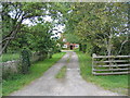
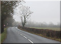
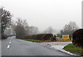
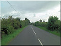
Photos of CV47 0AL


Area Information
CV47 0AL represents a specific residential cluster within the historic market town of Southam, Warwickshire. This postcode covers an area measuring 3.9 hectares and houses a population of 2,490 people. Residents here benefit from a location situated along an ancient drover's route, offering a blend of rural countryside and a charming market town atmosphere. The town itself dates back to the Domesday Book, having been a Royal manor before passing to Coventry Priory in the 11th century. You will find yourself in an environment where history is tangible, with landmarks like the Grade I listed St James parish church and the Old Mint public house, which was once used by King Charles I to coin money during the Civil War. Daily life in this area is paced by the quiet charm of a village feel without sacrificing practical access to amenities. The housing stock is primarily composed of houses rather than flats, reinforcing the traditional nature of the built environment. While the core area population estimates suggest around 2,490 residents, the wider civil parish was home to approximately 6,509 people in the 2001 census. Living in CV47 0AL means owning a piece of a locale that has survived over 800 years of English history while maintaining a manageable and intimate scale for its current inhabitants.
- Area Type
- Postcode
- Area Size
- 3.9 hectares
- Population
- 2490
- Population Density
- 287 people/km²
The property market in CV47 0AL is characterised by a strong presence of owner-occupied homes, with 77% of residents owning their dwellings outright or with a mortgage. This high ownership rate suggests a stable environment where families have invested in their local properties and intend to stay long term. The accommodation type is listed as Houses exclusively, meaning you will not find any apartments or flats within this specific postcode cluster. This housing stock caters to those seeking traditional living spaces, such as detached bungalows, semi-detached family homes, or terraced properties common in historic market towns. For buyers looking at homes in CV47 0AL, the market reflects a desire for permanence rather than short-term rental living. The combination of a 3.9 hectare area and a population of 2,490 people means the housing supply is relatively fixed. When searching for properties, you are likely to encounter a mix of historic houses dating back centuries alongside more modern iterations that respect the town's architectural fabric. The lack of rental stock implies that agents typically list these properties to fund investors or local families seeking to purchase. There is no data to suggest a high volume of temporary housing, reinforcing the idea that this is a genuine residential community.
House Prices in CV47 0AL
No properties found in this postcode.
Energy Efficiency in CV47 0AL
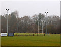
Daily life in CV47 0AL is supported by essential amenities located within practical reach of your home. You have access to five main retail locations nearby, ensuring your daily shopping needs are met without long travel times. Notable venues include the Tesco Southam, which offers a comprehensive range of groceries and household items, and the Heart of England Co-operative Co. These shops provide the convenience of weekly shopping directly to your doorstep. The area retains a small-town charm where these retail outlets serve the whole community of 2,490 people. Beyond shopping, the character of the area is enriched by its historic surroundings. You can explore landmarks such as Stoneythorpe Hall and the Chesterton Windmill during walks through the Warwickshire countryside. The bustling market square in Southam offers additional opportunities for dining and socialising. With a population density of 287 people per square kilometre, the area maintains a balance between quiet residential streets and accessible town centre facilities.
Amenities
Schools
Families living in or near CV47 0AL have access to education facilities within practical reach. The nearest school listed is St Mary's Catholic Primary School, located in Southam. This institution serves as a primary education provider for young children in the vicinity. There are no secondary schools listed in the immediate data for this specific postcode, so older children typically travel to facilities in the wider Warwickshire area. The presence of a Catholic primary school indicates that religious education is an important factor for many local parents. With a population density of 287 people per square kilometre and a median age of 47, the demand for primary schooling remains steady, though the overall population of 2,490 may spread pupil numbers across various catchment areas. You should verify current Ofsted ratings and admission policies directly with the school administration, as these details are not included in the core data provided. The mix of school types in Southam generally caters to diverse educational needs, from faith-based curriculums to comprehensive state provision nearby.
| Rank | School | Type | Entry gender | Ages |
|---|
Explore more schools in this area
Go to Schools tabDemographics
The community in CV47 0AL is defined by a settled population with a median age of 47 years. The most common age range consists of adults between 30 and 64 years old, indicating a neighbourhood populated by working families and established households rather than young students or retirees. This demographic profile aligns with a high level of property security, as 77% of residents are home owners. The remaining 23% likely rent their properties, contributing to a balanced but stable local market. Accommodation in this postcode is exclusively comprised of houses, catering to families and individuals seeking detached or semi-detached living rather than high-density flats. The predominant ethnic group is White, reflecting the broader makeup of Warwickshire and the West Midlands region. This demographic stability supports a close-knit community atmosphere where long-standing families often interact with newer neighbours. You are buying into an area where residents have deep roots and a clear understanding of local planning constraints and community needs. The population density averages 287 people per square kilometre, ensuring that the area feels lived-in yet spacious.
Household Size
Accommodation Type
Tenure
Ethnic Group
Religion
Household Composition
Age
Household Deprivation
NS-SEC
Explore more demographic insights in this area
Go to Demographics tabPlanning
Planning Constraints
- Flood RiskPremium
- Ramsar Wetland SitesPremium
- Area of Outstanding Natural BeautyPremium
- Protected Nature ReservePremium
- Protected WoodlandPremium