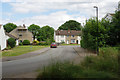
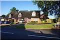
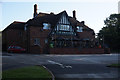
Area Overview for CV4 9QW
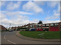
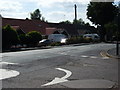
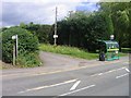
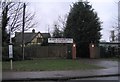
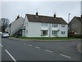
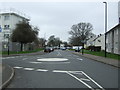
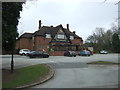
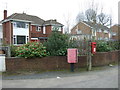
Photos of CV4 9QW

Area Information
Woodlands Ward, identified by the postcode CV4 9QW, is a compact residential cluster covering 7,137 square metres. Despite its small footprint, the area supports a population of 1,652 residents, resulting in a high density of 231,462 people per square kilometre. This concentration suggests a tightly knit neighbourhood where proximity to facilities is a key feature of daily life. The ward sits within Coventry, a city with a documented history stretching back at least a thousand years and granted city status by King Edward III in 1345. While the area has been part of Warwickshire since 1842, its location in the West Midlands places it in a region that once boomed due to cloth and wool industries. The physical space you would occupy in CV4 9QW is limited but connected to the broader urban fabric. You are living in an area where the built environment is dense, meaning you will have quick access to services but should expect to make regular use of public transport. The history of the local area includes significant educational infrastructure, such as Woodlands School, which influences the character of the ward. When considering living in CV4 9QW, you are choosing a location defined by its urban density and historical ties to Coventry's industrial past. The small size of the postcode area means that community life is likely to be straightforward and immediate, without the vast distances found in larger suburbs.
- Area Type
- Postcode
- Area Size
- 7137 m²
- Population
- 1652
- Population Density
- 4108 people/km²
Housing in CV4 9QW is characterised by a shortage of single-family homes and a strong presence of flat developments. With 37% of residents owning their homes, the area functions as a hybrid market with both private owners and tenants. The predominant accommodation type is flats, which dictates the architectural style and layout of the properties available for sale or rent in this postcode. You are likely viewing one or two-bedroom units rather than suburban semi-detached houses. This housing stock is consistent with the small area size of 7,137 square metres and the high density of living. The limited space of the associated ward means that green belts or large gardens are scarce. Instead, buyers here prioritise location convenience and distance to amenities over expansive grounds. The market in CV4 9QW is tightly regulated by the physical constraints of the land. When searching for homes in CV4 9QW, expect to find apartments within buildings that serve the immediate population of 1,652 people. Ownership rates suggest that many residents have stayed put, reducing the churn typical of high-turnover rental blocks. This stability can make flats more desirable for those seeking a permanent base in a central location. The property types here offer proximity to shops and transport hubs, which compensates for the lack of inner-space privacy. Property buyers must navigate an environment where vertical density replaces horizontal sprawl as the defining market feature.
House Prices in CV4 9QW
Showing 24 properties
| Address | Type | Beds | Baths | Last Sale Price | Last Sale Date | |
|---|---|---|---|---|---|---|
| 20 Shepherd Close, Coventry, CV4 9QW | Terraced | 3 | 1 | £195,000 | Feb 2025 | |
| 7 Shepherd Close, Coventry, CV4 9QW | Terraced | 3 | 1 | £176,000 | May 2024 | |
| 18 Shepherd Close, Coventry, CV4 9QW | Terraced | 3 | 1 | £100,000 | Sep 2020 | |
| 19 Shepherd Close, Coventry, CV4 9QW | Maisonette | 1 | 1 | £52,000 | Mar 2012 | |
| 12 Shepherd Close, Coventry, CV4 9QW | house | 2 | 1 | £85,000 | Nov 2011 | |
| 22 Shepherd Close, Coventry, CV4 9QW | Terraced | - | - | £88,000 | Aug 2008 | |
| 15 Shepherd Close, Coventry, CV4 9QW | Flat | - | - | £67,000 | Sep 2007 | |
| 11 Shepherd Close, Coventry, CV4 9QW | house | - | - | £98,000 | Mar 2007 | |
| 5 Shepherd Close, Coventry, CV4 9QW | house | - | - | - | - | |
| 14 Shepherd Close, Coventry, CV4 9QW | house | - | - | - | - |
Energy Efficiency in CV4 9QW
Your daily life in CV4 9QW benefits from a variety of nearby amenities clustered within practical reach. For shopping needs, you are surrounded by 5 retail outlets, including Farmfoods Allesley, Budgens Jardine, and Co-op Sutherland. These venues provide essential groceries and daily necessities without the need for long travel. Transport links are equally convenient, with access to 5 rail stations including Tile Hill Railway Station, Canley Railway Station, and Berkswell Railway Station. This network connects you to the wider UK rail system. For international travel, Coventry Airport is available within a short distance, offering 2 airport options for your flights. The presence of Farmfoods and Co-op outlets ensures you can stock up on supplies quickly before heading out. Living in CV4 9QW means you do not spend significant time commuting for basic services. The rail stations support your daily commute, while the airport supports long-distance travel. The proximity of these 5 retail and transport hubs creates a self-sufficient environment. You can combine a quick trip to Budgens Jardine with catching a train for work or a flight for a weekend break. The layout of these amenities supports a busy but convenient lifestyle. Every essential service is named and located near the postcode boundary.
Amenities
Schools
Education provision for families in CV4 9QW is supported by Limbrick Wood Primary School. This facility serves as the primary educational option listed for the area. You will find Limbrick Wood Primary School located near the residential cluster, providing local access for early years and primary education. The school is designated as a primary institution, catering to young children whose families reside in this dense postcode. While there are no secondary schools listed in the immediate vicinity, the presence of Limbrick Wood Primary establishes the area as having direct primary education access. The concentration of school listings highlights the importance of this facility to the ward. When evaluating homes in CV4 9QW, consider the catchment implications of Limbrick Wood Primary School. The school type matches the demographic profile of the ward, serving the families within the 30 to 64 age range. Although the area itself is small, the school represents a significant local institution. Parents seeking to live in CV4 9QW will need to understand the transport arrangements for reaching Limbrick Wood Primary School. The school is a named entity in the data, providing a concrete reference point for your school search. No other schools are recorded in the provided data, making Limbrick Wood Primary School the definitive choice for local education needs in this sector.
| Rank | School | Type | Entry gender | Ages |
|---|
Explore more schools in this area
Go to Schools tabDemographics
The community in CV4 9QW is dominated by adults, with the median age set at 47 years. The most common age range for residents falls between 30 and 64 years, indicating a population in the prime working and family-raising years. House ownership is a notable aspect of the area, with 37% of residents owning their homes. This figure suggests a mix of owner-occupiers and those renting, creating a diverse range of tenures. The predominant accommodation type in this specific cluster is flats, which aligns with the high population density of 231,462 people per square kilometre. This housing style supports the vertical living pattern found in central Coventry. The racial composition is predominantly White. You will find homes in CV4 9QW occupied by a mature demographic that has stabilised in the area. The absence of younger children in the median age group reflects the flat-dominated stock and the age profile of the workforce. When looking at who lives here, you are dealing with established residents rather than transient populations. The demographic data paints a picture of a settled community where a significant portion of the population has achieved home ownership while others opt for flat living. This balance creates a neighbourhood character driven by steadiness rather than rapid turnover. The age distribution means that schools nearby cater primarily to younger children, while the adult population supports local retail and service sectors.
Household Size
Accommodation Type
Tenure
Ethnic Group
Religion
Household Composition
Age
Household Deprivation
NS-SEC
Explore more demographic insights in this area
Go to Demographics tabPlanning
Planning Constraints
- Flood RiskPremium
- Ramsar Wetland SitesPremium
- Area of Outstanding Natural BeautyPremium
- Protected Nature ReservePremium
- Protected WoodlandPremium