Area Overview for CV4 9JE
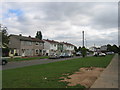
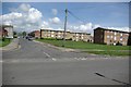
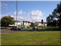
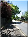
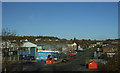
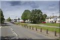
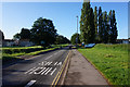
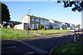
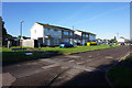
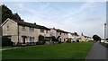
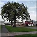
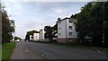
Photos of CV4 9JE
Area Information
CV4 9JE occupies a specific residential cluster within the Westwood Ward of Coventry, covering just 1994 square metres. Although the area is physically small, it supports a population of 1999 people, creating a dense neighbourhood feel. Historically, this land was part of the Stoneleigh Estate, featuring medieval common land and Cistercian monk granges before becoming part of Coventry in 1927. Today, the suburb of Westwood Heath forms the backdrop, characterised by enclosed farmland and ribbon housing dating back to the 1930s. The transition from semi-rural heathland to suburban development defines the local landscape. You will find homes situated near notable historical sites such as St John the Baptist Church, which opened in 1844, and Bockendon Grange Farm, an 18th-century building with possible medieval traces. While the area retains elements of its agricultural past, modern development includes business parks along roads like Westwood Heath Road and Cromwell Lane. Living in CV4 9JE means residing in a location that balances historical heritage with contemporary suburban convenience. The postcode addresses a mix of original hamlet settlements and later 20th-century expansion, offering a specific microcosm of Coventry's growth.
- Area Type
- Postcode
- Area Size
- 1994 m²
- Population
- 1999
- Population Density
- 2348 people/km²
The property market in CV4 9JE is dominated by houses, reflecting the area's historical development as a residential cluster within the Stoneleigh Estate. Only 34 per cent of homes in the area are owner occupied, indicating that rental properties or shared ownership schemes likely play a significant role in the local housing stock. This statistic of 34 per cent home ownership suggests a market where long-term residents are becoming more established, yet investment or let-to-own scenarios remain prevalent. The primary accommodation type is the house, consistent with the area's suburban character and ribbon housing along Westwood Heath Road. Buyers looking at homes in CV4 9JE should expect a focus on detached or semi-detached properties typical of the 20th-century expansion and original 1930s construction. The small total area size of 1994 square metres for the postcode suggests a high concentration of dwellings relative to the land available. This density implies that competition for specific properties may be intense for those seeking to purchase. You can expect a market driven by families and professionals who value the proximity to local amenities and historical landmarks like St John the Baptist Church.
House Prices in CV4 9JE
Showing 4 properties
| Address | Type | Beds | Baths | Last Sale Price | Last Sale Date | |
|---|---|---|---|---|---|---|
| 2 Milrose Way, Coventry, CV4 9JE | Bungalow | - | - | - | - | |
| 4 Milrose Way, Coventry, CV4 9JE | Bungalow | - | - | - | - | |
| 8 Milrose Way, Coventry, CV4 9JE | Bungalow | - | - | - | - | |
| 6 Milrose Way, Coventry, CV4 9JE | Bungalow | - | - | - | - |
Energy Efficiency in CV4 9JE
Living in CV4 9JE places you within practical reach of several key amenities, provided you travel short distances to the wider surrounding areas. Retail options include five local shops, with Farmfoods Allesley and Budgens Jardine serving as notable provisions points. For larger shopping trips, residents have access to Costco Coventry, offering extensive goods. Transport links are strong, with five railway stations nearby including Tile Hill, Canley, and Berkswell. Two airports, both identified as Coventry Airport, offer aviation connectivity within easy reach. Although the postcode covers a small residential cluster, these amenities are effectively part of your daily environment. The presence of a railway network integrated with local buses allows for straightforward commutes into Coventry city centre. You can rely on these facilities for groceries, travel, and leisure needs without excessive travel time. The combination of retail chains and rail links defines the lifestyle convenience available to homeowners and renters alike in this specific area.
Amenities
Schools
Families residing in CV4 9JE have access to Finham Park 2, an academy-style school located nearby. This institution holds a good Ofsted rating, providing parents with a positive educational option for their children. The presence of an academy within easy reach of the postcode area aligns with the community's demographic trend towards family households. There are no other schools listed in the immediate vicinity of CV4 9JE in the provided data, making Finham Park 2 the primary reference point for local education. The good rating of this academy suggests a standard of education that meets government expectations for quality teaching and pupil progress. For residents requiring primary or secondary education, this school serves as the main nearby facility. The specific mention of an academy type indicates the establishment operates under the same standards as traditional schools but with greater autonomy over its curriculum and staffing. Living in an area with a good-rated academy adds significant value to the local environment for those prioritising school choices.
| Rank | School | Type | Entry gender | Ages |
|---|
Explore more schools in this area
Go to Schools tabDemographics
The community in CV4 9JE reflects a young adult demographic with a median age of 22 years. Adults aged between 30 and 64 constitute the most common age range, suggesting a stability that contrasts with the low median age figure. Housing stock consists primarily of houses, rather than flats or apartments. Currently, 34 per cent of residents are home owners, while the majority reside in rented accommodation or other tenures. The predominant ethnic group is White, aligning with the broader character of the Coventry South area. This profile indicates an area popular with families settling down or younger professionals establishing roots. The high population density of 1,002,686 people per square kilometre, derived from the small area size and total population, results in a tight-knit community feel despite the modest footprint. These figures paint a picture of a dynamic population centre where homeowners and renters coexist within a concentrated residential zone. Local life revolves around the specific neighbourhood needs of this demographic mix.
Household Size
Accommodation Type
Tenure
Ethnic Group
Religion
Household Composition
Age
Household Deprivation
NS-SEC
Explore more demographic insights in this area
Go to Demographics tabPlanning
Planning Constraints
- Flood RiskPremium
- Ramsar Wetland SitesPremium
- Area of Outstanding Natural BeautyPremium
- Protected Nature ReservePremium
- Protected WoodlandPremium