Area Overview for CV4 9HQ
Photos of CV4 9HQ
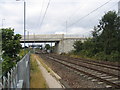
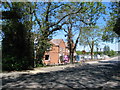
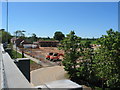
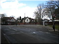
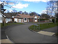
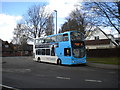
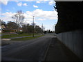
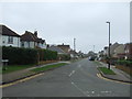
44 photos from this area
Area Information
Key information about the CV4 9HQ including its size, population, and administrative classification.
- Area Type
- Postcode
- Area Size
- 2.3 hectares
- Population
- 1494
- Population Density
- 1406 people/km²
House Prices in CV4 9HQ
19
Properties
£154,346
Average Sold Price
£51,000
Lowest Price
£290,000
Highest Price
Showing 19 properties
| Address | Type | Beds | Baths | Last Sale Price | Last Sale Date | |
|---|---|---|---|---|---|---|
| 15 Treedale Close, Coventry, CV4 9HQ | Bungalow | 2 | 1 | £282,500 | Nov 2024 | |
| 16 Treedale Close, Coventry, CV4 9HQ | Bungalow | 2 | 1 | £231,250 | Oct 2022 | |
| 19 Treedale Close, Coventry, CV4 9HQ | Bungalow | - | - | £161,500 | Mar 2022 | |
| 1 Treedale Close, Coventry, CV4 9HQ | Bungalow | - | - | £290,000 | Mar 2021 | |
| 2 Treedale Close, Coventry, CV4 9HQ | Bungalow | - | - | £210,000 | Jul 2018 | |
| 3 Treedale Close, Coventry, CV4 9HQ | Bungalow | 3 | - | £174,000 | Jan 2017 | |
| 5 Treedale Close, Coventry, CV4 9HQ | Bungalow | - | - | £185,000 | Apr 2016 | |
| 12 Treedale Close, Coventry, CV4 9HQ | Bungalow | 2 | 1 | £93,333 | Sep 2014 | |
| 18 Treedale Close, Coventry, CV4 9HQ | Bungalow | 3 | 1 | £159,000 | Jul 2014 | |
| 11 Treedale Close, Coventry, CV4 9HQ | Bungalow | 2 | - | £145,000 | Sep 2011 |
Page 1 of 2
Energy Efficiency in CV4 9HQ
Amenities
Schools
| Rank | School | Type | Entry gender | Ages |
|---|
Explore more schools in this area
Go to Schools tabDemographics
Household Size
Two person
most common
Accommodation Type
Houses
most common
Tenure
76
majority
Ethnic Group
White
most common
Religion
N/A
most common
Household Composition
N/A
most common
Age
47
median
Adults (30-64 years)
most common
Household Deprivation
N/A
with no deprivation
NS-SEC
40
in Lower managerial occupations
Explore more demographic insights in this area
Go to Demographics tabPlanning
Planning Constraints
- Flood RiskPremium
- Ramsar Wetland SitesPremium
- Area of Outstanding Natural BeautyPremium
- Protected Nature ReservePremium
- Protected WoodlandPremium