Area Overview for CV4 9GX
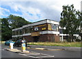
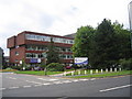
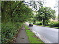
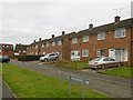
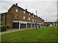
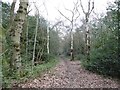
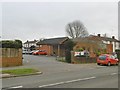
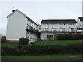
Photos of CV4 9GX
Area Information
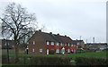
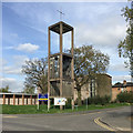
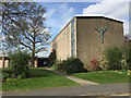
Living in CV4 9GX offers a specific lifestyle within the Westwood Ward of Coventry City Council. This postcode covers a small residential cluster spanning just 1.3 hectares, housing a population of 1,733 people. The location sits in the southwest of Coventry, positioned as a semi-rural area that is transitioning into suburban development. Historically, the land was part of the Stoneleigh Estate hamlet before becoming part of Coventry in 1927. Today, the character is defined by enclosed farmland and ribbon housing dating back to the 1930s along Westwood Heath Road and Cromwell Lane. You are entering a neighbourhood where modern suburban life blends with the history of the region, which features sites such as St John the Baptist Church and Bockendon Grange Farm from the 18th century. The small size of the cluster means daily life is intimate, yet connected to broader amenities. The area sits near coordinates 52.393016, -1.59143, marking it as part of a larger suburb of Coventry known as Westwood Heath. Residents enjoy proximity to the original agricultural landscapes before the 20th-century expansion included business parks. The history of the place is deep, referencing Stoneleigh Rolls from 1250 and associations with Cistercian monk granges from the 1150s. This backdrop provides a sense of continuity while you navigate a space that balances historical heritage with contemporary living standards.
- Area Type
- Postcode
- Area Size
- 1.3 hectares
- Population
- 1733
- Population Density
- 5264 people/km²
The property market in CV4 9GX is characterised by a strong presence of owner-occupiers. With a home ownership rate of 50%, this area is more stable than many new development sites where rental ratios are higher. This balance suggests a market where buyers are likely looking for security and long-term investment rather than short-term lets. The dominant accommodation type is Houses, which fits the semi-rural and suburban character of the Westwood Ward. You are looking at an environment where individual homes sit within a setting that includes enclosed farmland and ribbon housing from the 1930s. For prospective buyers, the small area size of 1.3 hectares limits the inventory, creating a concentrated market. This concentration often means that property changes hands less frequently than in larger urban zones. The history of the area as part of the Stoneleigh Estate and its subsequent development into a suburb in 1927 has created a legacy of distinct housing types. There is no mention of council housing or social housing in the provided data, which further reinforces the idea of a middle-class residential enclave. The presence of notable historical features like Bockendon Grange Farm and St John the Baptist Church adds to the prestige of the location without necessarily inflating prices to the point of exclusivity. The mix of 18th-century structures and 20th-century coffee shops indicates a well-maintained environment. Buyers should expect a market where home values are supported by ownership rates and the unique heritage of the Westwood Heath location.
House Prices in CV4 9GX
Showing 16 properties
| Address | Type | Beds | Baths | Last Sale Price | Last Sale Date | |
|---|---|---|---|---|---|---|
| 8 Blanchfort Close, Coventry, CV4 9GX | Terraced | 3 | 2 | £252,500 | Sep 2025 | |
| 1 Blanchfort Close, Coventry, CV4 9GX | Terraced | 4 | 4 | £290,000 | Jun 2023 | |
| 9 Blanchfort Close, Coventry, CV4 9GX | house | - | - | £235,000 | Apr 2022 | |
| 11 Blanchfort Close, Coventry, CV4 9GX | house | - | - | £221,050 | Sep 2021 | |
| 7 Blanchfort Close, Coventry, CV4 9GX | house | - | - | £196,000 | Mar 2021 | |
| 5 Blanchfort Close, Coventry, CV4 9GX | Terraced | 3 | 3 | £216,000 | Dec 2020 | |
| 4 Blanchfort Close, Coventry, CV4 9GX | Terraced | 3 | 1 | £220,000 | Sep 2019 | |
| 15 Blanchfort Close, Coventry, CV4 9GX | Semi-detached | 3 | 2 | £230,000 | Jan 2019 | |
| 16 Blanchfort Close, Coventry, CV4 9GX | Semi-detached | 3 | 2 | £225,000 | Jun 2018 | |
| 3 Blanchfort Close, Coventry, CV4 9GX | Terraced | 3 | 2 | £200,000 | Sep 2016 |
Energy Efficiency in CV4 9GX
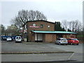
Daily life in CV4 9GX is supported by a variety of amenities within practical reach. For shopping and food, five retail venues are nearby. These include Farmfoods Allesley, Budgens Jardine, and the Heart of England Co-operative Co. These supermarkets and convenience stores provide everything from daily groceries to household essentials. You have clear, established places to go for your regular weekly shop without needing to travel far. Transport options are also close by, with five rail stations including Tile Hill, Canley, and Berkswell Railway Station. These stations are convenient for daily commutes or weekends away. There are two airports nearby as well, with Coventry Airport listed twice in the local data, likely indicating its proximity to the route. This dual air-rail access gives you flexibility in how you travel. The historical character of the area adds to the lifestyle experience. You can enjoy the sight of enclosed farmland and the historic St John the Baptist Church while walking around. The presence of Bockendon Grange Farm offers a glimpse into the 18th century. The mix of 1930s ribbon housing and modern developments creates a neighbourhood with layers of history. The area feels like a living extension of the Stoneleigh Estate, offering a slower pace than the city centre but ready access to modern comforts.
Amenities
Schools
Families living in CV4 9GX have access to a specific range of educational institutions nearby. The primary options listed within practical reach include Hereward College of Further Education and the Oakwood Centre. Hereward College of Further Education is a sixth-form provider, meaning it caters to older students in their late teens. This option provides pre-university education and vocational training for young adults living in the Westwood Ward. The Oakwood Centre is listed as an "other" type of educational facility. Its specific function is not detailed in the data, so it does not appear to be a standard primary or secondary school for younger children. These are the only two educational entities mentioned in the vicinity of the postcode. There is no data provided on Ofsted ratings for these institutions, nor are there mentions of primary or secondary schools with specific performance metrics. This limited selection of named schools suggests that CV4 9GX may rely on facilities further away for compulsory education. The presence of a sixth-form college indicates that young adults in the area have a local institution for their final years of schooling. The "other" status of the Oakwood Centre leaves room for further investigation, but it cannot be assumed to be a primary school without evidence. For parents, the nearest educational infrastructure is defined by these two points, and the absence of primary school data means that searching for primary education may require looking beyond the immediate cluster.
| Rank | School | Type | Entry gender | Ages |
|---|
Explore more schools in this area
Go to Schools tabDemographics
The community in CV4 9GX has a distinct demographic profile that reflects a mature residential area. The median age for residents is 47 years, indicating a population heavily weighted towards older demographics. Most commonly, the area is made up of Adults between 30 and 64 years old. This age distribution suggests a neighbourhood where stability is common, often appealing to families and established professionals who are looking to settle down permanently. Home ownership plays a significant role in the social fabric here, with 50% of residents owning their homes outright. This figure indicates that half of the population has achieved a level of financial security that allows for long-term planning. The remaining households may include first-time buyers or investors, but the high ownership rate points to a community invested in the long-term value of their property. Regarding diversity, the data indicates that White residents are the predominant ethnic group in this specific postcode. The area is not described as having significant ethnic diversity based on current figures. The accommodation type is almost exclusively Houses, which contrasts with high-rise flats or terraced rows seen in other parts of the city. This focus on detached or semi-detached properties aligns with the suburban character. There is no data provided on deprivation levels, so the quality of life must be inferred from the housing stock and the age profile rather than economic indicators.
Household Size
Accommodation Type
Tenure
Ethnic Group
Religion
Household Composition
Age
Household Deprivation
NS-SEC
Explore more demographic insights in this area
Go to Demographics tabPlanning
Planning Constraints
- Flood RiskPremium
- Ramsar Wetland SitesPremium
- Area of Outstanding Natural BeautyPremium
- Protected Nature ReservePremium
- Protected WoodlandPremium