Area Overview for CV4 9DT
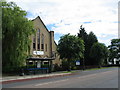
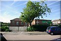
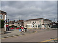
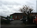
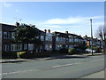
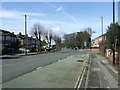
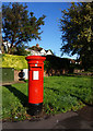
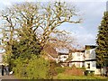
Photos of CV4 9DT


Area Information
Living in CV4 9DT offers a distinct experience within the Westwood Ward of Coventry City Council. This specific postcode covers a small residential cluster spanning just 4843 square metres. The area sits in the southwest of Coventry, blending semi-rural elements with suburban development. Originally part of the Stoneleigh Estate, this locality has transitioned from agricultural land to a recognised suburb since 1927. It remains a compact environment where residents share a defined neighbourhood identity. The population here stands at 1906 people, creating a tight-knit community feel despite the transition to modern housing. You will find homes situated near historic landmarks and evolving business parks. The area is characterised by ribbon housing from the 1930s alongside later twentieth-century developments. Daily life in CV4 9DT involves a balance of quiet residential streets and proximity to key transport links. The suburb features enclosed farmland and older heathland traces, offering green spaces that separate housing clusters. Residents enjoy access to significant historical sites including St John the Baptist Church and Bockendon Grange Farm. These features contribute to the area's unique character as a place where history intersects with modern living. For those considering homes in CV4 9DT, the scale of the postcode ensures you are not living in a vast, sprawling development but rather in a concentrated settlement. This density can foster stronger local connections while providing easy access to the wider city infrastructure. The location serves as a practical base for commuters, positioning you well between the city centre and the surrounding countryside.
- Area Type
- Postcode
- Area Size
- 4843 m²
- Population
- 1906
- Population Density
- 4996 people/km²
The housing stock in CV4 9DT is defined by specific ownership and structural characteristics. Fifty-one per cent of households own their properties, marking this postcode as a zone where owner-occupation is the norm. This figure indicates that the area is not a transient rental market but one of settled residents. Accmmodation type data confirms that houses dominate the local landscape. You will find detached, semi-detached, and terraced houses, all adhering to a house-based architectural style. There are no high-rise apartments or purpose-built rental estates within this cluster. The density of 393553 people per square kilometre reflects the intensity of this small residential patch, yet the primary dwelling remains the single-family home. For buyers searching for homes in CV4 9DT, the high proportion of owner-occupied stock suggests a market of people who have chosen to put down roots. This stability often translates to well-maintained properties and engaged neighbours. The accommodation type constraints mean you cannot expect to find luxury flats or purpose-built student accommodation here. Instead, the market offers traditional family homes. These properties are situated along established roads like Westwood Heath Road and Cromwell Lane, which feature ribbon housing from the 1930s. Later developments have added business parks and newer housing clusters. The mix of history and new construction provides variety. When you consider purchasing a home in this postcode, you are entering a market with limited volume due to the small geographical footprint. This scarcity can influence local property values and demand dynamics. Whether you are an existing owner of the 51 per cent or an incoming buyer, the property types here serve enduring residential needs rather than short-term stays.
House Prices in CV4 9DT
Showing 17 properties
| Address | Type | Beds | Baths | Last Sale Price | Last Sale Date | |
|---|---|---|---|---|---|---|
| 381 Tile Hill Lane, Coventry, CV4 9DT | Terraced | 3 | 1 | £195,000 | Sep 2025 | |
| 365 Tile Hill Lane, Coventry, CV4 9DT | Terraced | 3 | 1 | £170,000 | Feb 2024 | |
| 357 Tile Hill Lane, Coventry, CV4 9DT | Terraced | 3 | 1 | £151,000 | Feb 2019 | |
| 355 Tile Hill Lane, Coventry, CV4 9DT | Terraced | 3 | 1 | £167,500 | Sep 2018 | |
| 371 Tile Hill Lane, Coventry, CV4 9DT | Terraced | 3 | 1 | £173,500 | Jun 2018 | |
| 367 Tile Hill Lane, Coventry, CV4 9DT | house | - | - | £135,000 | Mar 2017 | |
| 361 Tile Hill Lane, Coventry, CV4 9DT | Terraced | 4 | - | £140,000 | Mar 2015 | |
| 385 Tile Hill Lane, Coventry, CV4 9DT | Terraced | 3 | 1 | £145,000 | Dec 2014 | |
| 359 Tile Hill Lane, Coventry, CV4 9DT | Terraced | 3 | 2 | £110,000 | Sep 2006 | |
| 377 Tile Hill Lane, Coventry, CV4 9DT | Terraced | 3 | 1 | £48,000 | Apr 1998 |
Energy Efficiency in CV4 9DT
Life in CV4 9DT is supported by a range of amenities within practical reach. You have access to five retail locations, creating a convenient local hub for shopping. Heart of England Co-operative Co, Costco Coventry, and Sainsburys Canley are among the stocked supermarkets and co-op stores nearby. These venues provide fresh groceries, household essentials, and family brands without requiring a long drive. For commuting to work, rail infrastructure plays a central role. Five rail stations cluster around the area, offering frequent services to the wider West Midlands. Canley Railway Station, Tile Hill Railway Station, and Berkswell Railway Station provide the slow train journey links needed for daily work commutes. Leisure and travel options extend further to Coventry Airport, which counts as two notable amenities due to its operational capacity. This airport allows for regional flights and private aviation needs. The surrounding landscape includes green corridors and farmland that define the residential character. St John the Baptist Church, built in 1844, stands as a focal point for community events and history. Nearby Bockendon Grange Farm adds a rural touch to the modern suburbs. You can enjoy walks through areas that were once part of the Stoneleigh Estate. These features enrich the lifestyle beyond simple utility. The proximity to schools near CV4 9DT is implied by the residential nature, though specific school names were not listed in the provided data. Local shops and train stations are integrated into the daily routine. For residents, the blend of retail, rail, and aviation options creates a versatile living environment that meets both practical and recreational needs.
Amenities
Schools
| Rank | School | Type | Entry gender | Ages |
|---|
Explore more schools in this area
Go to Schools tabDemographics
The community residing in CV4 9DT reflects a balanced demographic profile with a median age of 22 years. While the area includes younger residents, adults between the ages of 30 and 64 represent the most common age range. This suggests a mix of young families and established professionals. Fifty-one per cent of residents own their homes, indicating a stable population with long-term roots in the locality. The remaining households are likely private renters or living with family assistance. Accommodation in CV4 9DT consists primarily of houses rather than high-rise flats. This structure supports a traditional neighbourhood layout with private gardens and street-facing dwellings. The predominant ethnic group in this postcode area is White, which aligns with wider patterns in Coventry's suburban wards. The low median age reveals that new generations are moving into the area, bringing energy and changing needs. However, the concentration of working-age adults means you will find neighbours who appreciate quiet streets and green corridors. The home ownership rate of 51 per cent is significant for a small area of its size, suggesting many families plan to stay. Ownership levels can correlate with investment in local schools and community spaces. When you look at homes in CV4 9DT, you see a stock favoured by those seeking stability. The demographic mix supports local businesses that require a consistent customer base. Understanding this population helps you identify the types of neighbours who shape the daily life of the street.
Household Size
Accommodation Type
Tenure
Ethnic Group
Religion
Household Composition
Age
Household Deprivation
NS-SEC
Explore more demographic insights in this area
Go to Demographics tabPlanning
Planning Constraints
- Flood RiskPremium
- Ramsar Wetland SitesPremium
- Area of Outstanding Natural BeautyPremium
- Protected Nature ReservePremium
- Protected WoodlandPremium