Area Overview for CV4 9AJ
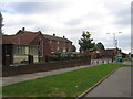
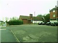
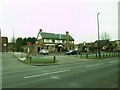
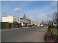
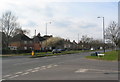
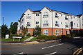
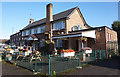
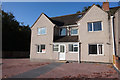
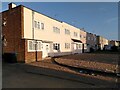
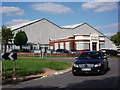
Photos of CV4 9AJ


Area Information
Living in CV4 9AJ offers a distinct combination of suburban living within Southwest Coventry. This specific postcode covers a small residential cluster measuring just over one hectare, yet it accommodates a population of 1,639 people. As part of the Westwood Ward, the area represents a transition from agricultural pastures to established suburban development. Geographically, it sits near coordinates 52.393016, -1.59143, positioning it conveniently for access to broader city amenities while maintaining a local community identity. The landscape here is not dominated by high-density blocks but rather features enclosed farmland elements and ribbon housing along routes like Westwood Heath Road. Historically, this location traces its roots back to the 1250 Stoneleigh Rolls and the Knights Templars, evolving from medieval granges into the semi-rural estate it originally was before its formal incorporation into Coventry in 1927. Today, the suburb retains hints of its heritage, most notably through sites like St John the Baptist Church, which opened in 1844, and the historic Bockendon Grange Farm. For someone seeking homes in CV4 9AJ, you gain access to a neighbourhood that blends pockets of greenery with modern conveniences. You are sixty minutes from Coventry Airport's flight path influence but enjoy direct rail links to surrounding stations. This balance of history, understated green space, and proximity to business hubs makes it a practical choice for families seeking stability.
- Area Type
- Postcode
- Area Size
- 1.0 hectares
- Population
- 1639
- Population Density
- 3838 people/km²
Understanding the property market in CV4 9AJ requires looking at the underlying structure of the housing stock. The area is overwhelmingly owner-occupied, with statistics showing that 67% of homes are owned outright or with a mortgage. This contrasts sharply with areas that serve as major rental hubs, suggesting that property values here reflect long-term investment rather than speculative tenancy. The predominant accommodation type in this cluster is houses, meaning you will find an abundance of detached and semi-detached properties rather than flats or converted apartments. This housing mix suits families looking for space and traditional layouts, aligning with the area's suburban history. For buyers seeking homes in CV4 9AJ, the market operates within a constrained supply environment. The total population of 1,639 residents living in just over one hectare of land implies a limited number of individual dwellings in this specific postcode. Consequently, competition for upgraded family homes could be stiff. However, the high ownership rate often means that properties are sold to individuals who have carefully considered the neighbourhood's suitability, often leading to stable valuations. Potential buyers should expect to navigate a market where motivation is often driven by life-stage changes rather than investment flips. The prevalence of houses also means that buyers value garden space and parking, features that define utility in this specific part of Coventry's suburbs.
House Prices in CV4 9AJ
Showing 12 properties
| Address | Type | Beds | Baths | Last Sale Price | Last Sale Date | |
|---|---|---|---|---|---|---|
| 186 Torrington Avenue, Coventry, CV4 9AJ | general_industrial | - | - | - | - | |
| 228 Torrington Avenue, Coventry, CV4 9AJ | Flat | - | - | - | - | |
| 226 Torrington Avenue, Coventry, CV4 9AJ | Flat | - | - | - | - | |
| 222 Torrington Avenue, Coventry, CV4 9AJ | Flat | - | - | - | - | |
| 220 Torrington Avenue, Coventry, CV4 9AJ | Flat | - | - | - | - | |
| 230 Torrington Avenue, Coventry, CV4 9AJ | Flat | - | - | - | - | |
| 224 Torrington Avenue, Coventry, CV4 9AJ | Flat | - | - | - | - | |
| Car Wash City, Unit 1, 194 Torrington Avenue, Coventry, CV4 9AJ | Industrial | - | - | - | - | |
| Degos Autos, Unit 2, 194 Torrington Avenue, Coventry, CV4 9AJ | Industrial | - | - | - | - | |
| Bella's Valeting, Car Wash, 194 Torrington Avenue, Coventry, CV4 9AJ | Industrial | - | - | - | - |
Energy Efficiency in CV4 9AJ
Daily life in CV4 9AJ is anchored by a practical range of amenities located just a short drive away. Residents benefit from five major retail outlets that cater to everyday needs. You will find Costco Coventry, Heart of England Co-operative Co, and Farmfoods Allesless nearby, providing everything from bulk grocery shopping to household essentials. These stores service the immediate vicinity of CV4 9AJ, ensuring you do not need to travel far for weekly provisions. For those who prefer wider shopping destinations, the area is well-positioned to access larger parks and leisure facilities in Coventry city centre, though specific district names were not recorded in the immediate amenity list. Transport links further enhance your lifestyle convenience. Five railway stations, including Canley Railway Station and Tile Hill Railway Station, are accessible, allowing quick commutes to the city or suburbs. Additionally, two airports, notably Coventry Airport, are within practical reach, making weekend getaways or urgent business trips straightforward. The area also hosts notable local features that add character to your weekends, such as St John the Baptist Church, which opened in 1844, and the historic Bockendon Grange Farm. You can enjoy walks along the ribbon housing spots of Westwood Heath Road, blending residential peace with accessible green spaces. This blend of modern retail, efficient transport, and historical landmarks creates a balanced environment for living in CV4 9AJ, where convenience does not require sacrificing local charm.
Amenities
Schools
Families considering CV4 9AJ have access to a stream of educational institutions immediately adjacent to their homes. The area benefits from a cluster of schools with established reputations, providing options for early education and primary schooling. Directly on your doorstep lies Templars Primary School, which holds a good Ofsted rating, ensuring a quality educational standard for children in the catchment area. Beyond this highly rated institution, you will also find Templars Junior School and Templars Infant School nearby. These establishments represent a typical primary educational pathway, offering continuity for children as they progress through the initial years of formal learning. The mix of these schools means that parents can select the specific phase of education that suits their child's needs, whether that involves infant or junior schooling within the Templars group. While secondary school data is not listed for this specific immediate radius, the presence of a primary cluster supports a family-friendly profile for the postcode. Living in CV4 9AJ places you within a reasonable commute to these facilities, reducing travel time for morning drop-offs. This educational proximity is a significant factor for residents, particularly those working in the Westwood Ward area or commuting further afield. The availability of multiple primary options within walking or short driving distance adds practical value to any property purchase in this cluster.
| Rank | School | Type | Entry gender | Ages |
|---|
Explore more schools in this area
Go to Schools tabDemographics
The community in CV4 9AJ is defined by a mature demographic structure, with 67% of residents choosing to own their homes. This high ownership rate indicates a stable, settled neighbourhood where long-term residents form the bulk of the population. The area is primarily composed of houses, catering to families and established households rather than young professionals in rental flats. Your neighbours will likely fall into the adult age range of 30 to 64 years, reflecting the area's character as a place where people settle down rather than pass through. The median age sits at 47 years, confirming that the local population leans heavily towards middle and older age groups. While the predominant ethnic group is White, the area offers a standard representation of local diversity. With 1,639 residents living in such a compact space, the population density reaches 161,447 people per square kilometre. This figure seems high due to the small geographic footprint of the postcode, but in practice, it simply means a tight-knit cluster of residents. Because the area is dominated by owner-occupiers and houses, you will encounter fewer transient populations common in student zones or high-rise rental blocks. The community profile suggests a quiet, family-oriented atmosphere where residents have known each other for decades, fostering a sense of familiarity and security within the neighbourhood.
Household Size
Accommodation Type
Tenure
Ethnic Group
Religion
Household Composition
Age
Household Deprivation
NS-SEC
Explore more demographic insights in this area
Go to Demographics tabPlanning
Planning Constraints
- Flood RiskPremium
- Ramsar Wetland SitesPremium
- Area of Outstanding Natural BeautyPremium
- Protected Nature ReservePremium
- Protected WoodlandPremium