Area Overview for CV4 9AB
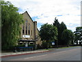
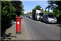
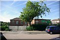
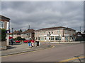
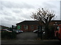
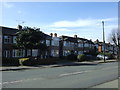
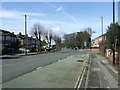
Photos of CV4 9AB

Area Information
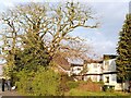
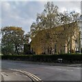
CV4 9AB is a compact residential postcode in Coventry’s southwest, encompassing a semi-rural area transitioning into suburban development. With a population of 1,639 spread over 5,964 square metres, it is densely populated, with 274,828 people per square kilometre. This small cluster lies within Westwood Ward, historically part of the Stoneleigh Estate, and is now a suburb marked by ribbon housing from the 1930s and later 20th-century growth. Daily life here blends suburban convenience with traces of its agricultural past, such as Bockendon Grange Farm. The area’s proximity to Coventry Airport and nearby railway stations offers connectivity, while Templars Primary School and its affiliated infant and junior schools serve local families. Residents benefit from a low crime risk score of 70 and no significant environmental constraints like flood zones or protected woodlands. The area’s character is defined by its enclosed farmland, historic churches, and 20th-century business parks, making it a mix of tradition and modernity.
- Area Type
- Postcode
- Area Size
- 5964 m²
- Population
- 1639
- Population Density
- 3838 people/km²
The property market in CV4 9AB is dominated by owner-occupied homes, with 67% of residents living in properties they own. The area’s accommodation type is primarily houses, indicating a focus on single-family dwellings rather than flats or apartments. This suggests a market skewed towards buyers seeking traditional homes rather than rental properties. The small size of the postcode means the housing stock is limited, with no indication of high-density development. For buyers, this implies a niche market where properties may be in high demand due to the area’s low crime risk and proximity to schools. However, the lack of data on property prices or recent sales means potential buyers should investigate local listings for current availability. The mix of older ribbon housing and 20th-century developments offers a range of styles, though the area’s semi-rural character may appeal to those seeking space without full countryside isolation.
House Prices in CV4 9AB
Showing 2 properties
| Address | Type | Beds | Baths | Last Sale Price | Last Sale Date | |
|---|---|---|---|---|---|---|
| Nastech Europe, Torrington Avenue, Coventry, CV4 9AB | Industrial | - | - | - | - | |
| Alliance Trading Estate, Torrington Avenue, Coventry, CV4 9AB | Industrial | - | - | - | - |
Energy Efficiency in CV4 9AB
Living in CV4 9AB offers a blend of suburban convenience and semi-rural tranquillity. Residents have access to five retail outlets, including Sainsburys Canley and Heart of England Co-operative Co, ensuring everyday shopping needs are met. The area’s railway stations—Canley, Tile Hill, and Berkswell—connect to broader transport networks, while nearby Coventry Airport provides additional travel options. The presence of St John the Baptist Church, built in 1844, and historic sites like Bockendon Grange Farm adds cultural and historical depth. For leisure, the area’s ribbon housing and enclosed farmland suggest opportunities for walking or cycling. The mix of retail, transport, and heritage sites creates a lifestyle that balances practicality with a connection to the past, making it appealing for those seeking a settled, community-focused environment.
Amenities
Schools
Residents of CV4 9AB have access to three primary schools within the area: Templars Primary School, Templars Junior School, and Templars Infant School. All three are primary institutions, providing education for children from early years through to primary level. Ofsted has rated Templars Primary School as “good,” indicating a satisfactory standard of education. The presence of multiple primary schools within the same postcode suggests a well-served community for young families, reducing the need for long commutes to education. The clustering of schools may also indicate a focus on localised schooling, which can foster a strong sense of community among parents and students. However, the absence of secondary schools in the data means families may need to look beyond CV4 9AB for high school options.
| Rank | School | Type | Entry gender | Ages |
|---|
Explore more schools in this area
Go to Schools tabDemographics
The population of CV4 9AB has a median age of 47, with adults aged 30–64 forming the most common age range. Home ownership stands at 67%, reflecting a community where many residents live in their own homes rather than renting. The predominant accommodation type is houses, suggesting a mix of family homes and older properties. The area’s demographic profile indicates a stable, middle-aged population with strong ties to the local area. The absence of specific data on deprivation means quality of life can be inferred from factors like low crime rates and proximity to amenities. With no significant ethnic diversity reported, the community is largely homogenous, centred around long-standing residents. This profile suggests a quiet, settled neighbourhood where families and older adults coexist, supported by nearby schools and transport links.
Household Size
Accommodation Type
Tenure
Ethnic Group
Religion
Household Composition
Age
Household Deprivation
NS-SEC
Explore more demographic insights in this area
Go to Demographics tabPlanning
Planning Constraints
- Flood RiskPremium
- Ramsar Wetland SitesPremium
- Area of Outstanding Natural BeautyPremium
- Protected Nature ReservePremium
- Protected WoodlandPremium