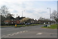
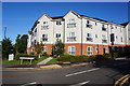
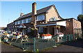
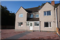
Area Overview for CV4 8ZZ
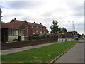
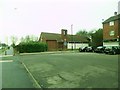
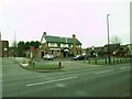
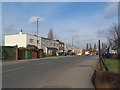
Photos of CV4 8ZZ

Area Information
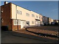
CV4 8ZZ is a small, residential postcode area in the southwest of Coventry, England, encompassing parts of Westwood Heath. With a population of 1355, it is a semi-rural suburb transitioning into suburban development. Originally part of the Stoneleigh Estate, the area was incorporated into Coventry in 1927 and retains historical traces of medieval land use, including 18th-century farmland and ribbon housing from the 1930s. Daily life here is shaped by its proximity to Coventry’s urban centres, with easy access to rail links and retail hubs like Costco Coventry. The area’s character blends enclosed green spaces with modern infrastructure, offering a quieter alternative to central Coventry while maintaining connectivity. Residents benefit from a low flood risk and proximity to St John the Baptist Church, a historic landmark dating to 1844. However, the area’s small size means it is best suited for those prioritising convenience over expansive living spaces.
- Area Type
- Postcode
- Area Size
- Not available
- Population
- 1355
- Population Density
- 3421 people/km²
The property market in CV4 8ZZ is characterised by a low home ownership rate of 20%, indicating that the majority of properties are rented rather than owned. Houses, rather than flats or apartments, dominate the accommodation type, reflecting a suburban layout with semi-detached and detached homes. This makes the area more suitable for buyers seeking traditional family homes rather than investment opportunities in rental portfolios. The small postcode area and limited housing stock suggest limited scope for property price fluctuations, though proximity to Coventry’s urban centres may offer growth potential. Buyers should consider the area’s semi-rural character and limited amenities when assessing its appeal.
House Prices in CV4 8ZZ
No properties found in this postcode.
Energy Efficiency in CV4 8ZZ
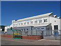
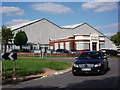
CV4 8ZZ offers a mix of retail, transport, and leisure options within practical reach. Nearby amenities include 5 retail outlets such as Costco Coventry, Aldi Canon, and Iceland Cannon, providing convenience for daily shopping. The area’s rail connections to Tile Hill, Canley, and Berkswell stations enhance mobility, while proximity to Coventry Airport (listed twice) may be relevant for frequent travellers. The semi-rural character of the area, with historical sites like Bockendon Grange Farm, contrasts with modern amenities, offering a blend of convenience and green space.
Amenities
Schools
The nearest school to CV4 8ZZ is Alderman Harris Primary School, which serves the local community with primary education. No secondary schools are listed in the data, meaning families may need to look beyond the immediate area for secondary education options. The presence of a primary school suggests the area is suitable for young families, though the absence of nearby secondary schools could be a consideration for those requiring a full range of educational facilities.
| Rank | School | Type | Entry gender | Ages |
|---|
Explore more schools in this area
Go to Schools tabDemographics
The population of CV4 8ZZ has a median age of 22, though the most common age range is 30-64 years, indicating a mix of younger residents and families. Only 20% of households are owner-occupied, suggesting a rental market dominance, with houses being the predominant accommodation type. The majority of residents identify as White, reflecting the area’s demographic profile. This low home ownership rate may impact long-term stability for buyers, though it also means the area is likely to attract a transient population. The absence of specific deprivation data means it is unclear how economic factors influence quality of life, but the presence of 5 retail outlets and multiple rail stations suggests reasonable access to services.
Household Size
Accommodation Type
Tenure
Ethnic Group
Religion
Household Composition
Age
Household Deprivation
NS-SEC
Explore more demographic insights in this area
Go to Demographics tabPlanning
Planning Constraints
- Flood RiskPremium
- Ramsar Wetland SitesPremium
- Area of Outstanding Natural BeautyPremium
- Protected Nature ReservePremium
- Protected WoodlandPremium