Area Overview for CV4 8JA
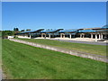
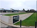
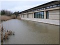
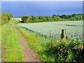
Photos of CV4 8JA


Area Information
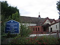
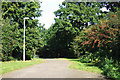
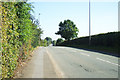
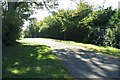
Living in CV4 8JA offers a quiet, settled experience within a defined residential cluster. This postcode covers a compact 1.4 hectares and supports a population of 1913 people. The density here reaches 1429 people per square kilometre, indicating a close-knit environment rather than a sprawling suburb. Located in the southwest of Coventry, this area blends semi-rural history with modern suburban living. It was originally part of the Stoneleigh Estate hamlet and became part of Coventry in 1927. Over the centuries, it transitioned from agricultural land with medieval common lands to the established neighbourhood you see today. The character of CV4 8JA is distinctively historical. It features sites associated with Cistercian monks and Knights Templars, alongside later development from the 1930s. You will find enclosed farmland alongside ribbon housing along Westwood Heath Road and Cromwell Lane. St John the Baptist Church, opened in 1844, stands as a central landmark dating back to when the local parish was constituted in 1846. For residents considering homes in CV4 8JA, the setting provides a peaceful backdrop away from heavy city traffic while remaining close to key infrastructure.
- Area Type
- Postcode
- Area Size
- 1.4 hectares
- Population
- 1913
- Population Density
- 1429 people/km²
The property market in CV4 8JA is characterised by a stable, owner-occupied base. With 82% of residents home-owners, the local housing stock is built for long-term settlement rather than short-term tenancy. This statistic shapes the nature of available properties and the pace of transaction. Within this specific postcode covering 1.4 hectares, the demand centres on established houses that suit families requiring space and quiet. The high ownership rate implies that sellers in CV4 8JA are often motivated by life changes rather than market speculation or portfolio management. When viewing homes in this area, you will typically find detached or semi-detached structures associated with the ribbon development from the 1930s and later expansion. The density of 1429 people per square kilometre suggests a compact neighbourhood where property values are influenced by proximity to specific local features like schools or amenities. Buyers looking at houses here should expect a market driven by practical needs for space and privacy. The lack of high-rise blocks or luxury flats aligns with the predominantly white demographic and the historical pattern of suburban expansion. Investigating homes in CV4 8JA reveals a market where price is often determined by the specific history and layout of individual properties rather than generic luxury branding.
House Prices in CV4 8JA
Showing 15 properties
| Address | Type | Beds | Baths | Last Sale Price | Last Sale Date | |
|---|---|---|---|---|---|---|
| Unit 7, Ensign Business Centre, Westwood Way, Coventry, CV4 8JA | office_workshop | - | - | - | - | |
| Unit 8, Ensign Business Centre, Westwood Way, Coventry, CV4 8JA | office_workshop | - | - | - | - | |
| Tellabs Com Uk Ltd, Unit 5, Ensign Business Centre, Westwood Way, Coventry, CV4 8JA | Office | - | - | - | - | |
| Unit 9, Ensign Business Centre, Westwood Way, Coventry, CV4 8JA | Office | - | - | - | - | |
| Unit 11, Ensign Business Centre, Westwood Way, Coventry, CV4 8JA | office_workshop | - | - | - | - | |
| Bpec Certification Ltd, Unit 15, Ensign Business Centre, Westwood Way, Coventry, CV4 8JA | office_workshop | - | - | - | - | |
| Unit 21, Ensign Business Centre, Westwood Way, Coventry, CV4 8JA | Office | - | - | - | - | |
| Units 2 And 3, Ensign Business Centre, Westwood Way, Coventry, CV4 8JA | office_workshop | - | - | - | - | |
| Assoc Of Plumbing And Heating Contractors, Unit 14 Ensign House, Ensign Business Centre, Westwood Way, Coventry, CV4 8JA | office_workshop | - | - | - | - | |
| Unit 4, Ensign Business Centre, Westwood Way, Coventry, CV4 8JA | Office | - | - | - | - |
Energy Efficiency in CV4 8JA
Daily life in CV4 8JA revolves around a convenient mix of retail and transport hubs. Within practical reach, you have five retail outlets including Tesco Cannon, Iceland Cannon, and Aldi Canon. These stores provide essential groceries and daily necessities without requiring a long journey into the city centre. The area is further distinguished by its transport connectivity, with five notable rail stations nearby. Tile Hill, Canley, and Berkswell Railway Stations offer easy weekly or monthly travel to other parts of the West Midlands. Convenience extends to air travel as well, with two airport facilities located nearby. Coventry Airport is accessible from this postcode, providing a distinct advantage for residents needing to travel abroad. This combination of local shops and regional transport hubs creates a self-sufficient lifestyle within a relatively small 1.4 hectare area. You can run errands at Tesco or Iceland, then catch a train to the city, all while remaining in the peaceful setting of Westwood Ward. The presence of specific brands like Aldi confirms that mainstream retail chains have invested in this accessible location.
Amenities
Schools
Families residing in CV4 8JA have access to a range of education options within practical reach. The Westwood School, identified as a technology college, operates as a primary school and serves the younger children in the area. Older children at The Westwood Academy will find an academy setting that continues the educational journey with a good Ofsted rating. For secondary education, the WMG Academy for Young Engineers provides specialised training in science and technology, also holding a good Ofsted rating. The National Mathematics and Science College functions as an independent secondary option, offering an Ofsted rated good education for families seeking an alternative to state schools. This mix of school types ensures that parents have choices ranging from maintained academies to private institutions. The presence of schools with 'good' ratings across the state and independent sectors indicates a robust educational environment for CV4 8JA. Primary education begins at The Westwood School, supported by the secondary options nearby. If you are living in CV4 8JA, your children are close to multiple educational establishments. These institutions collectively offer a broad curriculum from primary years through to secondary levels, ensuring continuity in education without long commutes to central Coventry.
| Rank | School | Type | Entry gender | Ages |
|---|
Explore more schools in this area
Go to Schools tabDemographics
The community in CV4 8JA is defined by stability and maturity. The median age here is 47, reflecting a population dominated by adults aged between 30 and 64 years. This age profile suggests a neighbourhood suited to families and long-term residents rather than transient student populations. Home ownership stands at a commanding 82%, meaning the vast majority of households own their property outright or have a mortgage. This high level of ownership indicates strong roots in the area and a preference for stability over renting. The primary accommodation type in this postcode is houses, which aligns with the family-oriented demographic. The area is predominantly White, creating a cohesive cultural fabric for the 1913 residents living here. Because most people own their homes, there is a strong sense of permanence and investment in the immediate surroundings. The older demographic profile suggests that services and amenities cater to established families rather than young professionals seeking short-term lets. If you are looking for homes in CV4 8JA, you are entering an area where families have lived for generations. The 82% ownership rate ensures that local decisions often reflect the interests of long-term homeowners rather than institutional landlords.
Household Size
Accommodation Type
Tenure
Ethnic Group
Religion
Household Composition
Age
Household Deprivation
NS-SEC
Explore more demographic insights in this area
Go to Demographics tabPlanning
Planning Constraints
- Flood RiskPremium
- Ramsar Wetland SitesPremium
- Area of Outstanding Natural BeautyPremium
- Protected Nature ReservePremium
- Protected WoodlandPremium