Area Overview for CV4 8EX
Photos of CV4 8EX
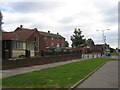
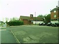
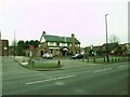
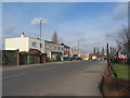
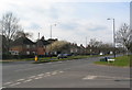
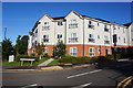
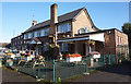
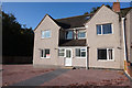
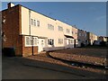

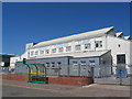
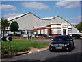
29 photos from this area
Area Information
Key information about the CV4 8EX including its size, population, and administrative classification.
- Area Type
- Postcode
- Area Size
- 6047 m²
- Population
- 1355
- Population Density
- 3421 people/km²
House Prices in CV4 8EX
33
Properties
£148,917
Average Sold Price
£96,500
Lowest Price
£230,000
Highest Price
Showing 33 properties
| Address | Type | Beds | Baths | Last Sale Price | Last Sale Date | |
|---|---|---|---|---|---|---|
| 41 Wendiburgh Street, Coventry, CV4 8EX | Semi-detached | 3 | 1 | £178,000 | Nov 2024 | |
| 33 Wendiburgh Street, Coventry, CV4 8EX | Semi-detached | 1 | 1 | £230,000 | Feb 2022 | |
| 37 Wendiburgh Street, Coventry, CV4 8EX | house | - | - | £140,000 | May 2015 | |
| 43 Wendiburgh Street, Coventry, CV4 8EX | Semi-detached | 7 | 3 | £96,500 | Feb 2011 | |
| 31 Wendiburgh Street, Coventry, CV4 8EX | Semi-detached | 4 | 1 | £127,000 | Aug 2007 | |
| 35 Wendiburgh Street, Coventry, CV4 8EX | house | - | - | £122,000 | Jul 2007 | |
| 15 Wendiburgh Street, Coventry, CV4 8EX | Semi-detached | 4 | - | - | - | |
| 11 Wendiburgh Street, Coventry, CV4 8EX | house | 1 | - | - | - | |
| 19 Wendiburgh Street, Coventry, CV4 8EX | undefined | - | - | - | - | |
| 23 Wendiburgh Street, Coventry, CV4 8EX | undefined | - | - | - | - |
Page 1 of 4
Energy Efficiency in CV4 8EX
Amenities
Schools
| Rank | School | Type | Entry gender | Ages |
|---|
Explore more schools in this area
Go to Schools tabDemographics
Household Size
Family (3-5 people)
most common
Accommodation Type
Houses
most common
Tenure
20
majority
Ethnic Group
White
most common
Religion
N/A
most common
Household Composition
N/A
most common
Age
22
median
Adults (30-64 years)
most common
Household Deprivation
N/A
with no deprivation
NS-SEC
14
in Lower managerial occupations
Explore more demographic insights in this area
Go to Demographics tabPlanning
Planning Constraints
- Flood RiskPremium
- Ramsar Wetland SitesPremium
- Area of Outstanding Natural BeautyPremium
- Protected Nature ReservePremium
- Protected WoodlandPremium